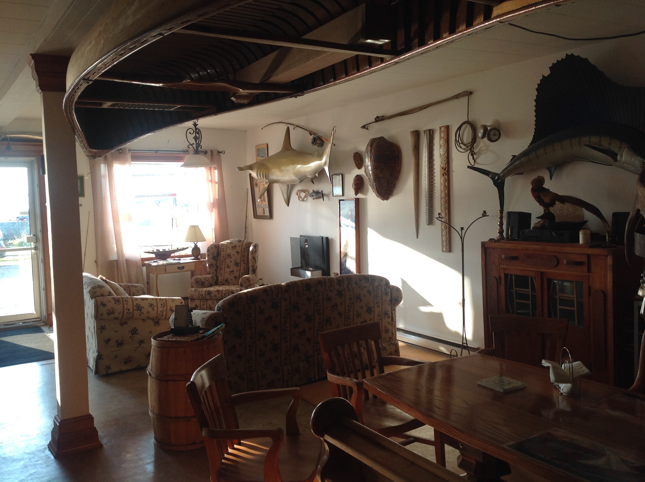
We hemmed and hawed all spring about whether we were going to continue this blog for another year, and then so many people spoke to us this summer about “being with us in Tad” through the blog that we have decided to keep going. We loved the idea of “being together”, even though far away, and we really have appreciated all the comments and emails that we have received – even those less than flattering ones (George) – from people who have forgotten to retire!!
One of our goals when we retired was to take a road trip down the North Shore to the end of the road. We just wanted to see more of our province where we have never explored. So we decided to take a week and explore all the way to Kegaska which is the end of the road – Route 138 – but not the end of the North Shore. The drive between Tadoussac and Kegaska is 850 km or about 9 hours but we wanted to go into all the little villages and bays and take lots of time on beaches and on hikes. We did the trip up and back in 5 nights and 6 days. The weather gods were with us and with the exception of one cloudy, windy day we had rain only one night and beautiful sun the rest of the visit.
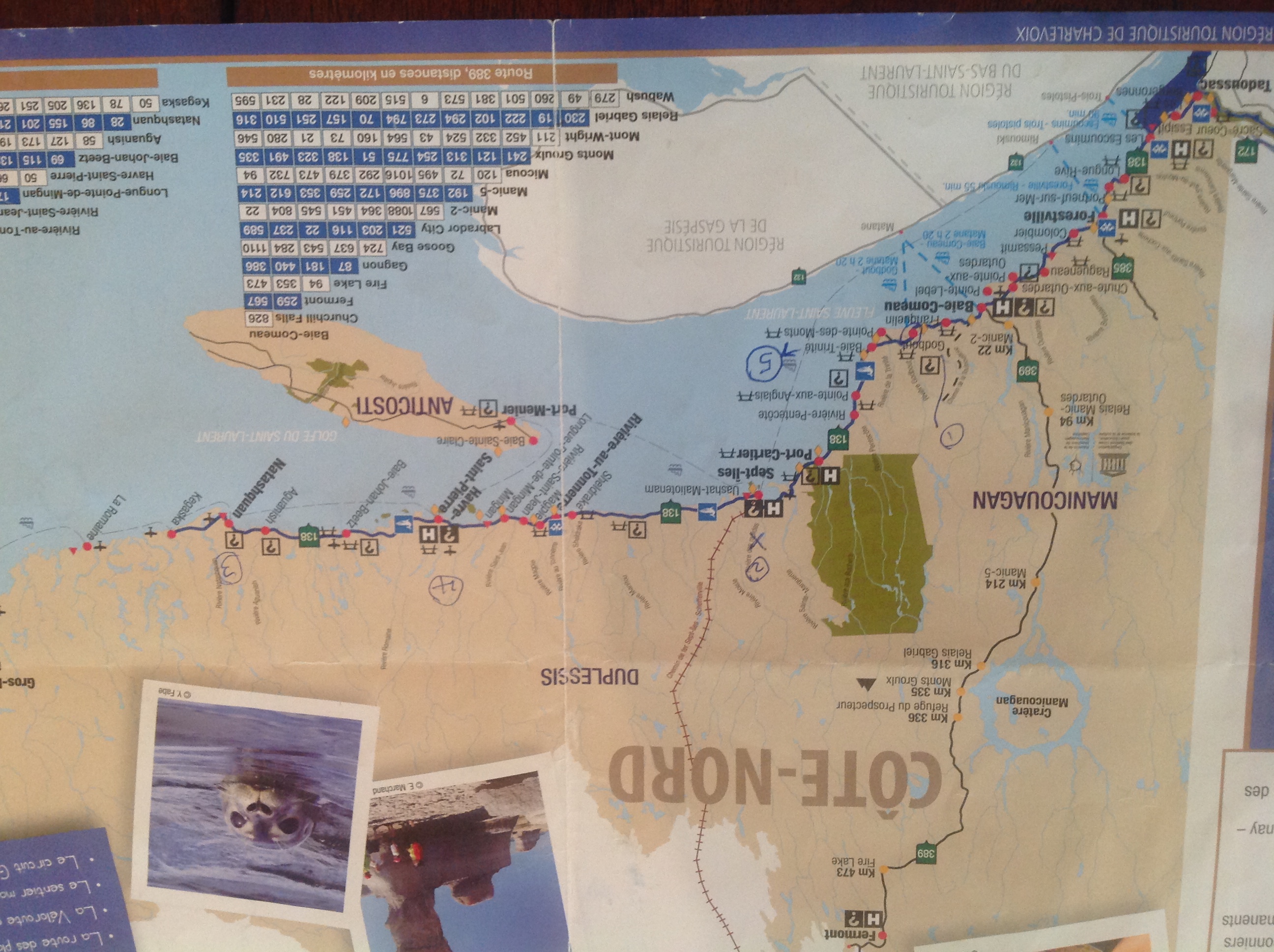
So just to orient those who may not know the area here is a map. But I am not sure how readable it will be. Tadoussac is down on the bottom left corner and Kegaska is the last dot on the right above the far end of Anticosti Island. We visited some of the towns on the way up, and some on the way back, but for simplicity sake we have put them in geographically chronological order from Tadoussac to Kegaska.
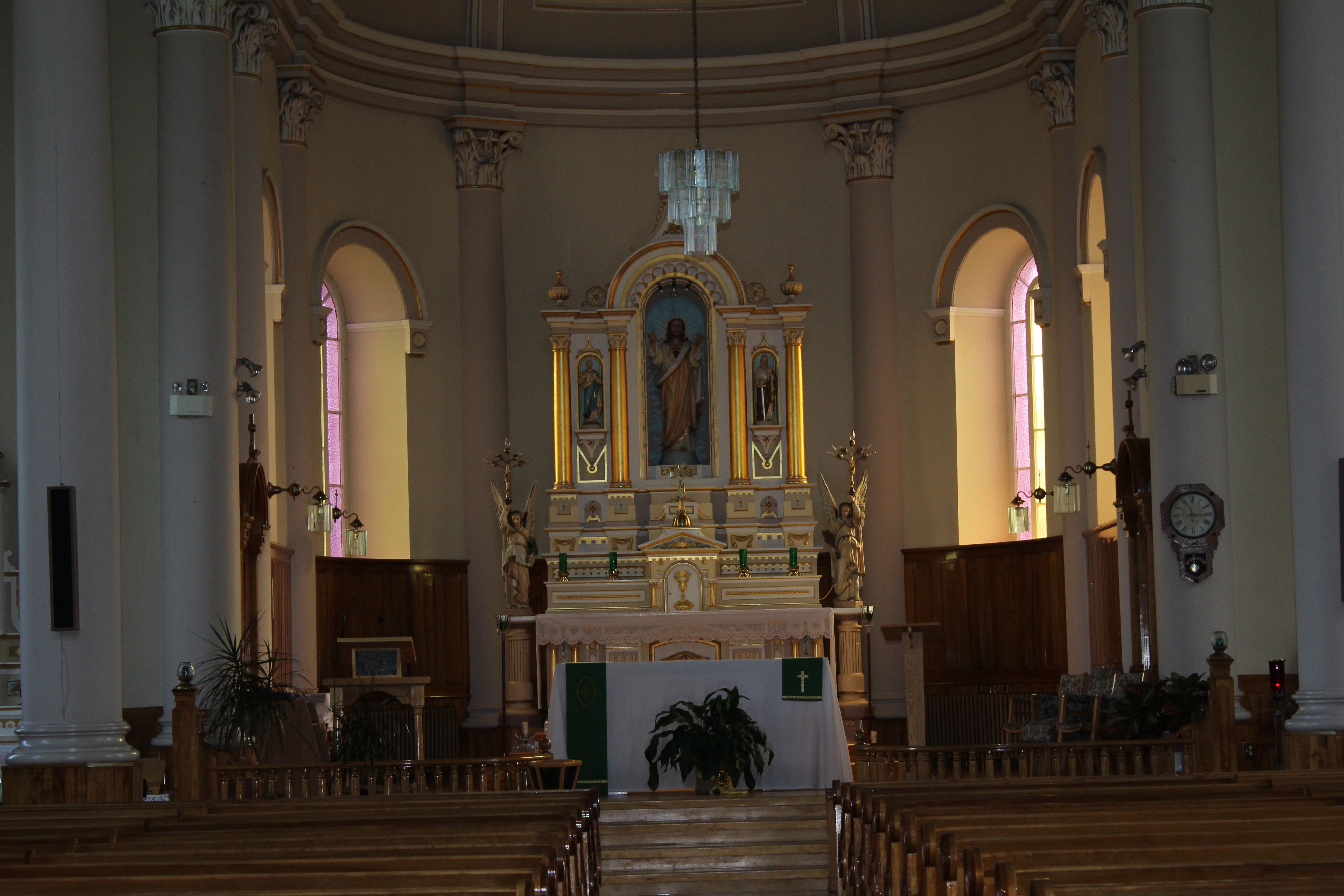
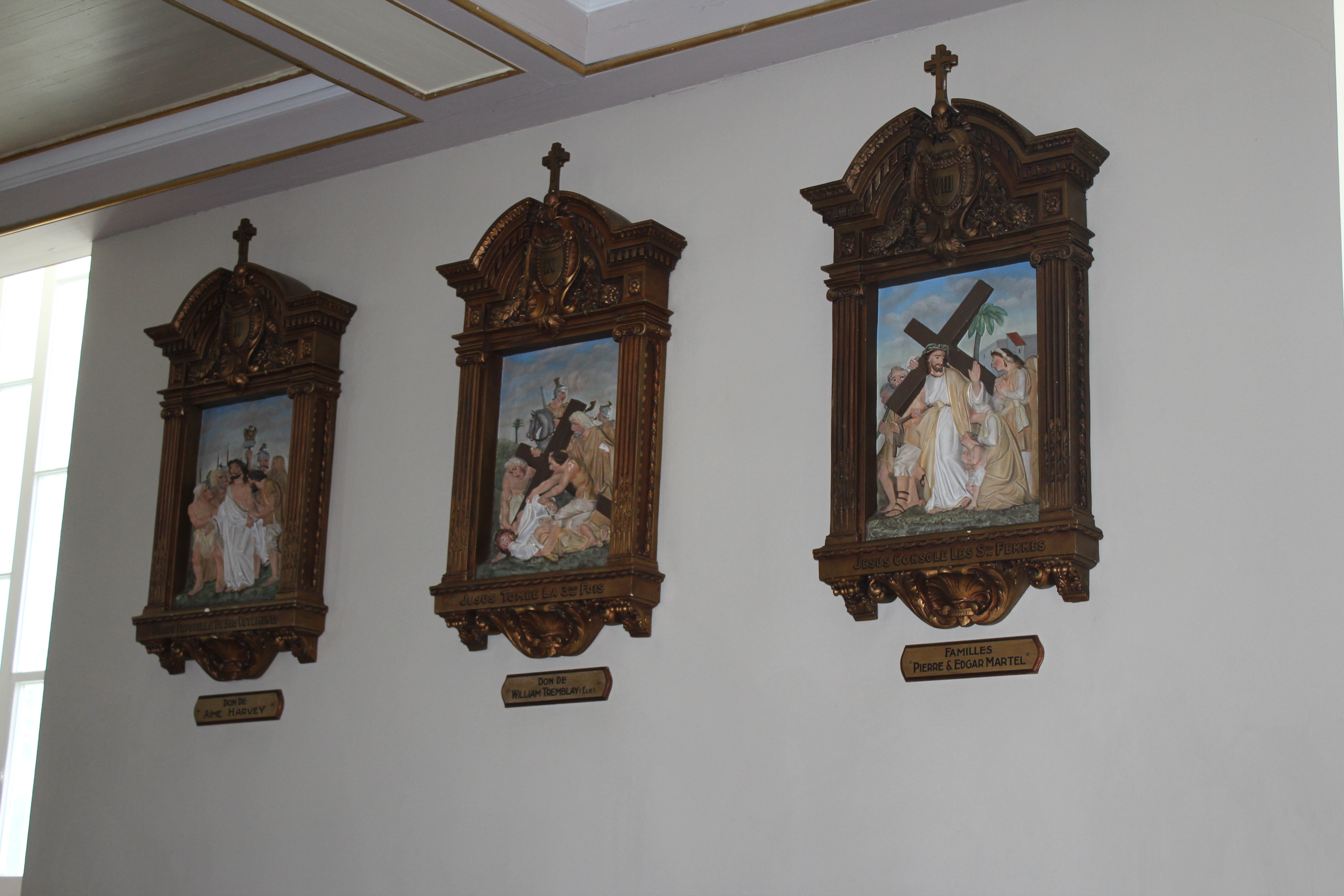
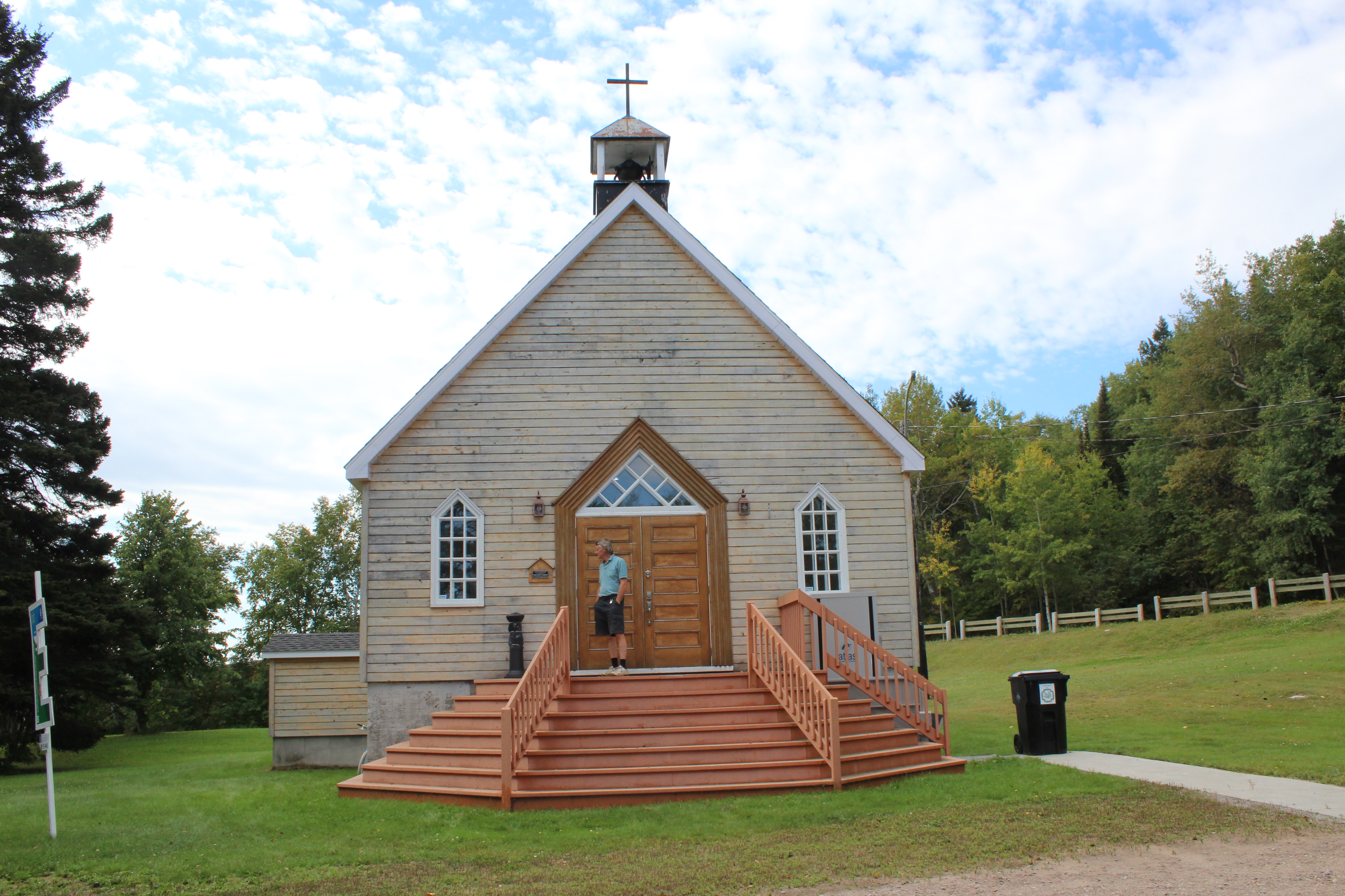
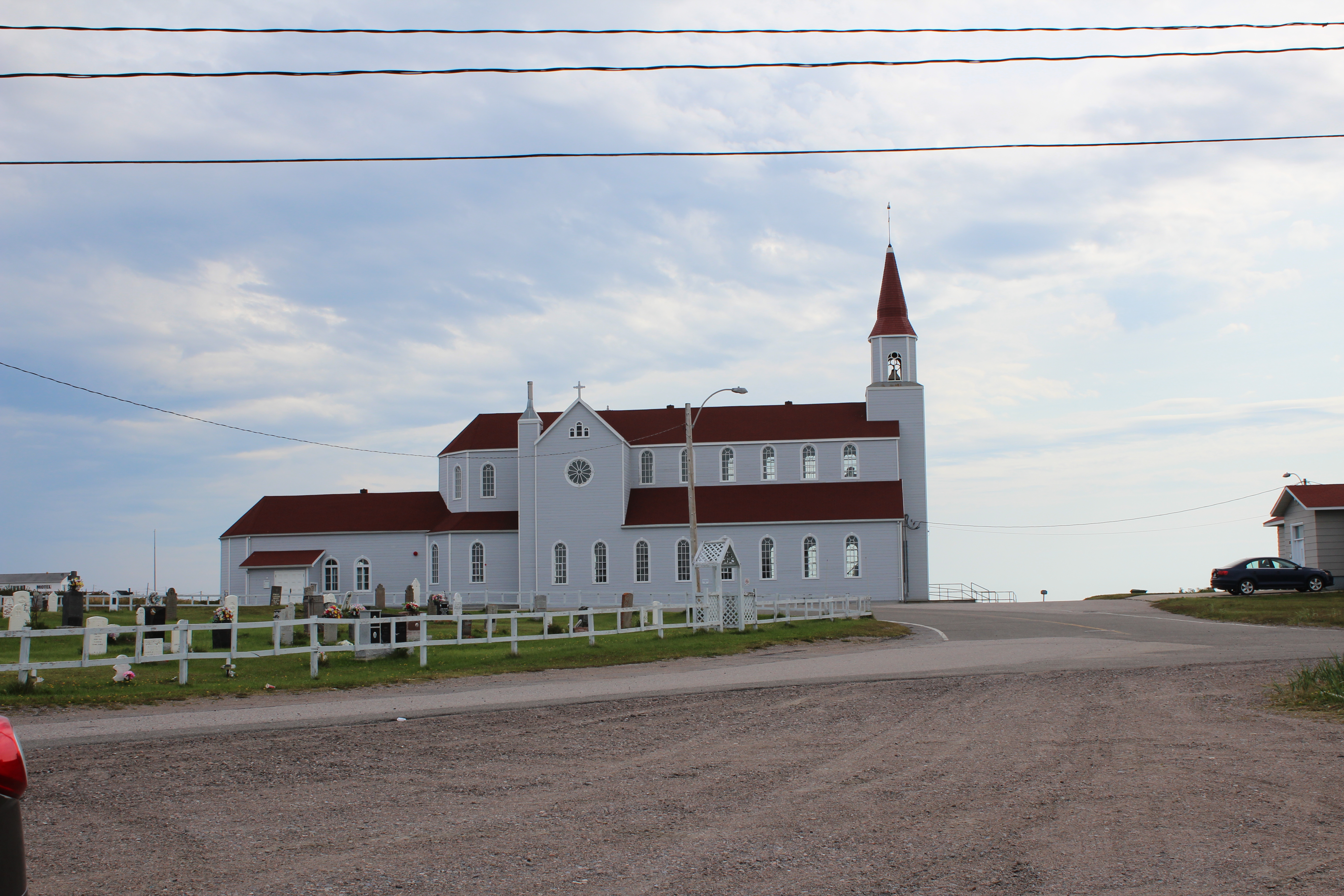
We started by exploring in our own area. We stopped at the beautiful church in Longue Rive which is actually in the same parish as the Catholic church here in Tadoussac. As is often the case, St Paul’s Church in Longue Rive is right on the highest point of the village on the best property which looks out over the sea.


We also stopped to visit the wharf in Port Neuf sur Mer.
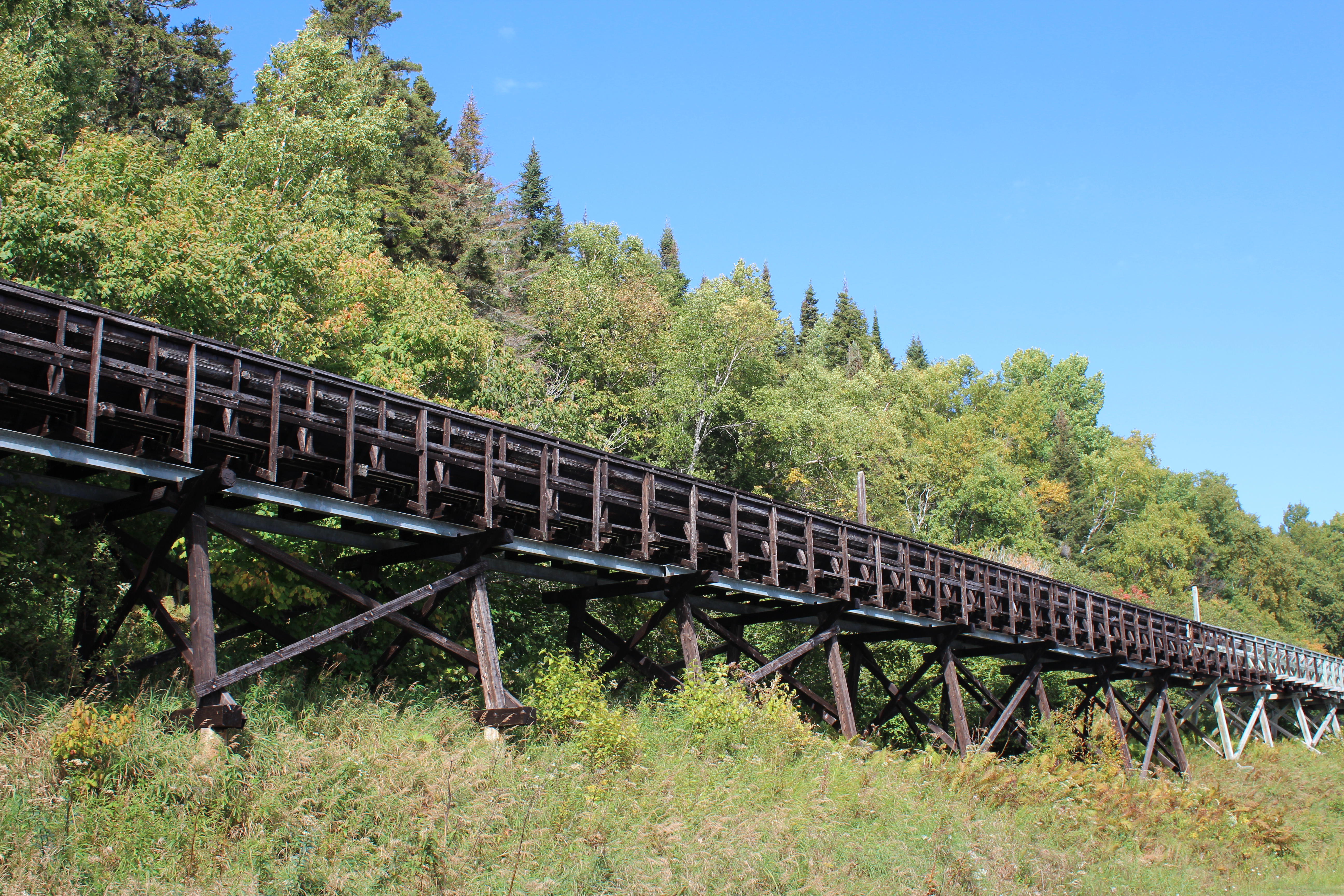
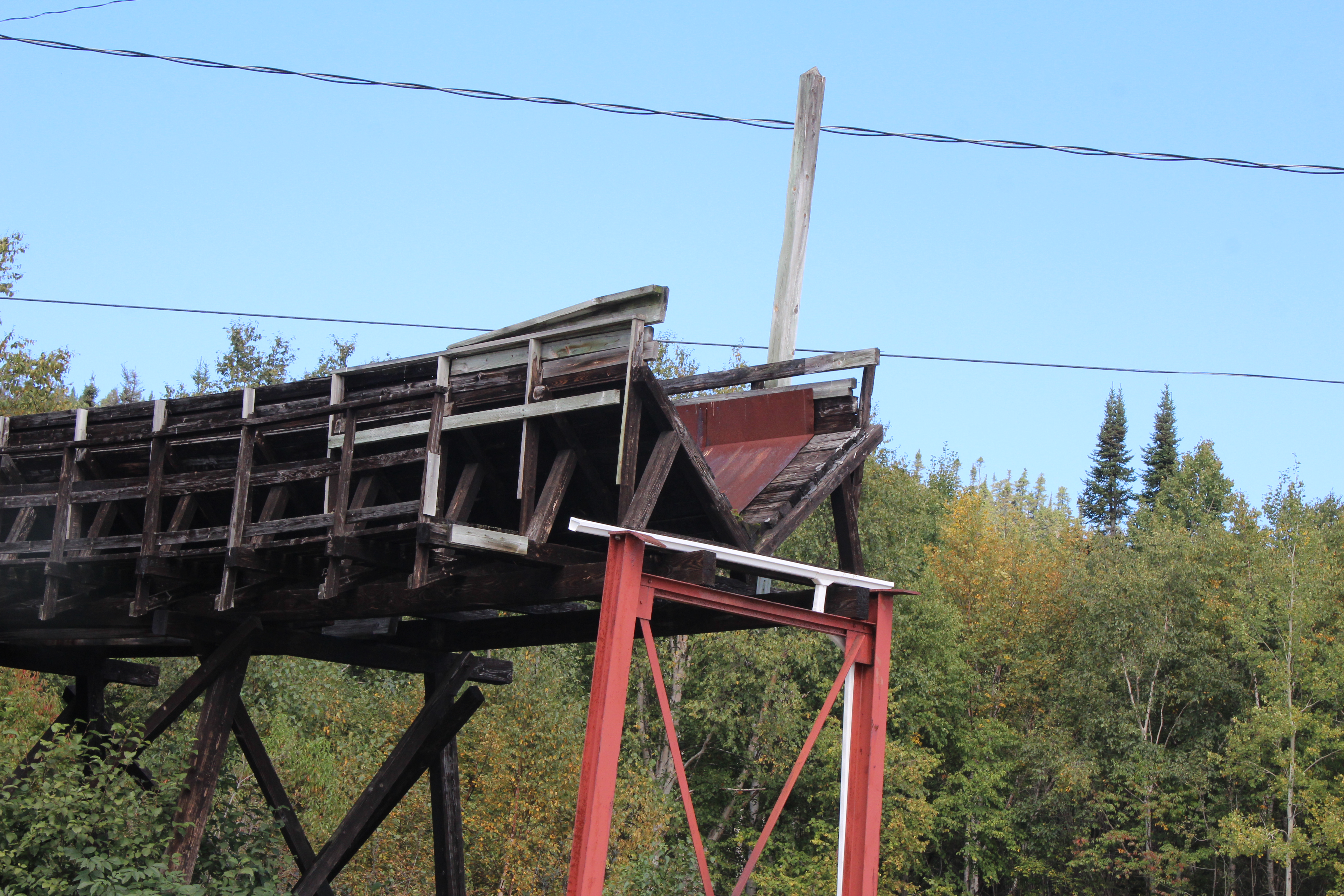
In Forestville we went to the ferry dock to see the log sluice that runs along that road. In the early days of forestry in that area when logs were being brought to the dock to be loaded on ships the foresters sent the logs to the dock by sluice. There were platforms running along the sides of the structures so that workers could prevent log jams and keep things running smoothly.
Alan’s turn
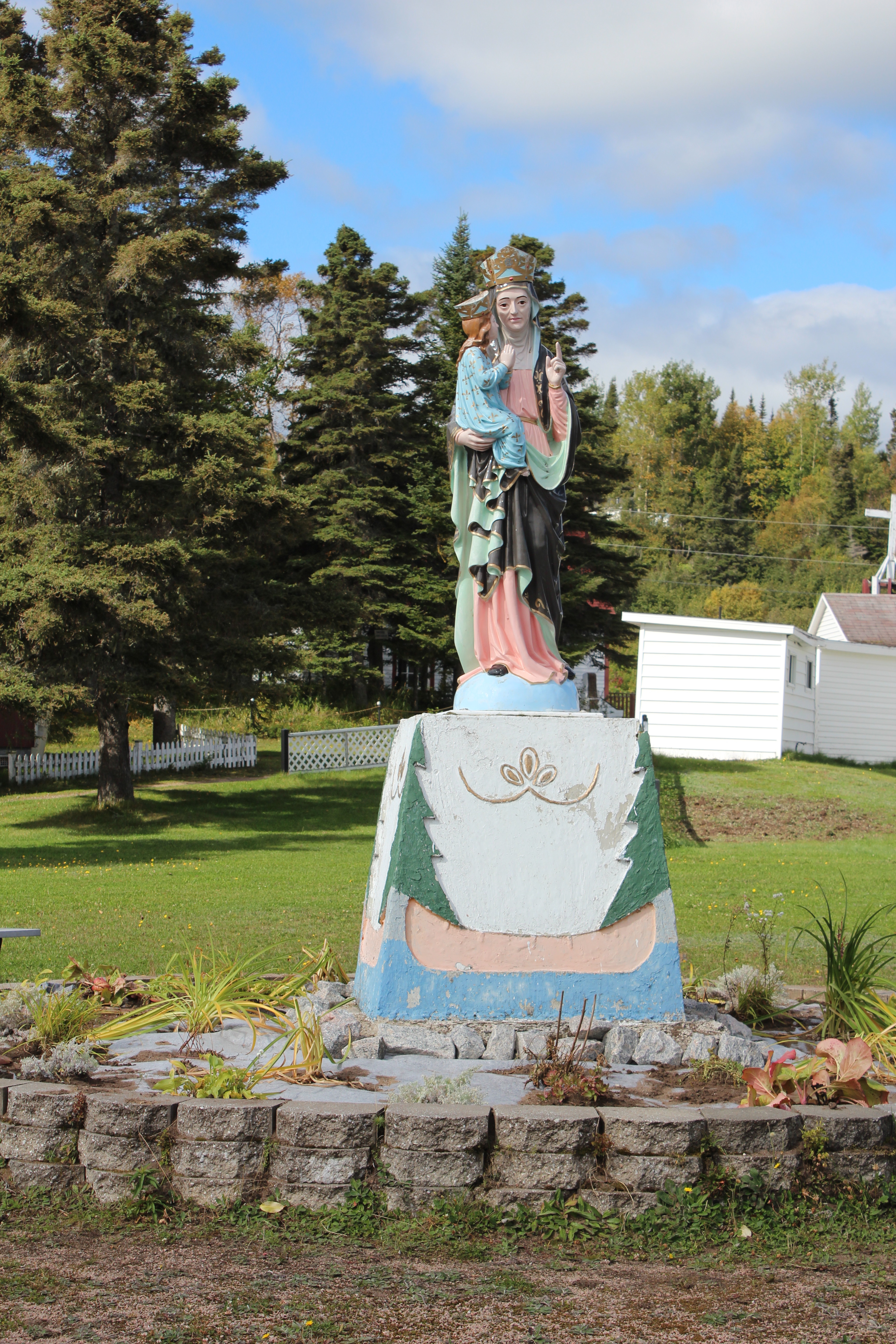
When I went through the travel brochures prior to the trip I noted which sites I wanted to see and ignored those I did not want to see. Les Ilets Jérémie, for example, boasts a replica of the Indian Chapel at Tadoussac and I thought it would be fun to see that. Because of an unscheduled (and not to be repeated) side trip into the over-advertized community of Cap de Colombier, we missed Les Ilets de Jérémie where we intended to take a pause for lunch. We carried on down the road to find a place called Ragueneau which sounded familiar but wasn’t on my list. It had the symbol for a look-out so we headed bravely off on the side-road thinking no evil. When I saw the statues I remembered why I had left it off the list.
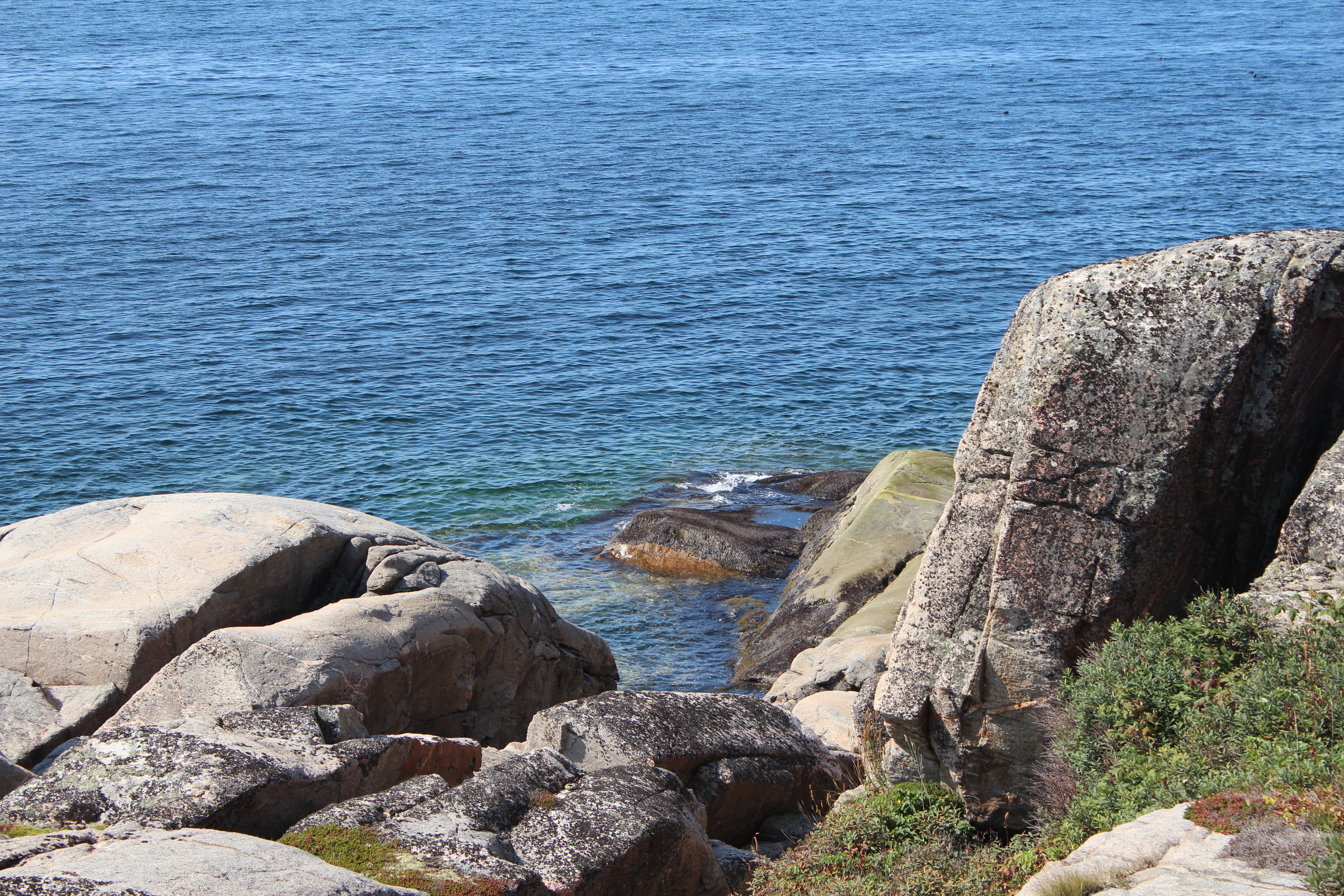
Here is a beautiful and pristine example of the Lower North Shore with all the rugged, rocky beauty of Bon Désir writ large. The wind blowing in among off-shore islets, scrubby vegetation atop low outcrops of coloured granite, unspoiled beauty at its finest.
When one Renald Girard first saw this place he must have been as impressed as I was. But where I might say, “Gee Jane, this place is beautiful,” he was far more imaginative. He must have said something like, “Gee Celeste, this place is beautiful, AND you know what would make it absolutely perfect?” “No,” she undoubtedly replied, because no one on God’s green earth could possibly have guessed what he would then say. “This place just cries out for two full size dinosaurs and a 100 foot obelisk!”

And to our horror, that’s just what he built. The dinosaurs are a symbol for the heart and strength of the pioneers and for the power of the local natural surroundings. The obelisk, plinth, churchless steeple, God’s belly scratcher, (thanks Al Purdy) call it what you will, symbolizes the volunteering spirit among the local people and there are eight little, strange, nondescript circles included around the base giving praise to the MRC and the eight nearby municipalities. Or so says the plaque at the bottom of the obelisk. It needed explanation in my view. Neither Jane nor I, in spite of no small amount of university education between us, were quite on the ball enough to say, “Oh look Dear, two dinosaurs – that must be a symbol for the strength of the pioneering spirit…!”
If I may say a word to the gentlemen reading this (and ladies, I’d prefer it if you skipped this part) one of the things we count on from our wives is to tell us when our latest ideas that we are terribly enthusiastic about are actually hopelessly crazy. I don’t know if our man Renald was ever married and if he was there’s only a very small chance his wife’s name was Celeste. Nevertheless the symbol of the utter folly that resides at Pointe Ragueneau for me will always be some Celeste (God rest her soul) who lacked either the wit or the courage to say, “Renald, that’s crazy and it simply IS NOT HAPPENING!”
Please thank your wives for their continuing good judgement. After all, your wife must have good judgement. She married you!
That said we did stop at Les Ilets de Jérémie on the way back and I must admit that it was a disappointment. There is a smaller replica of our Indian Chapel and a Catholic Conference center attached right next to a native cemetery. It is a pilgrimage center dedicated to Ste Anne (of whom there is a statue) but compared with the imaginative folly of Rageneau, it just lacks a certain je ne sais quoi.
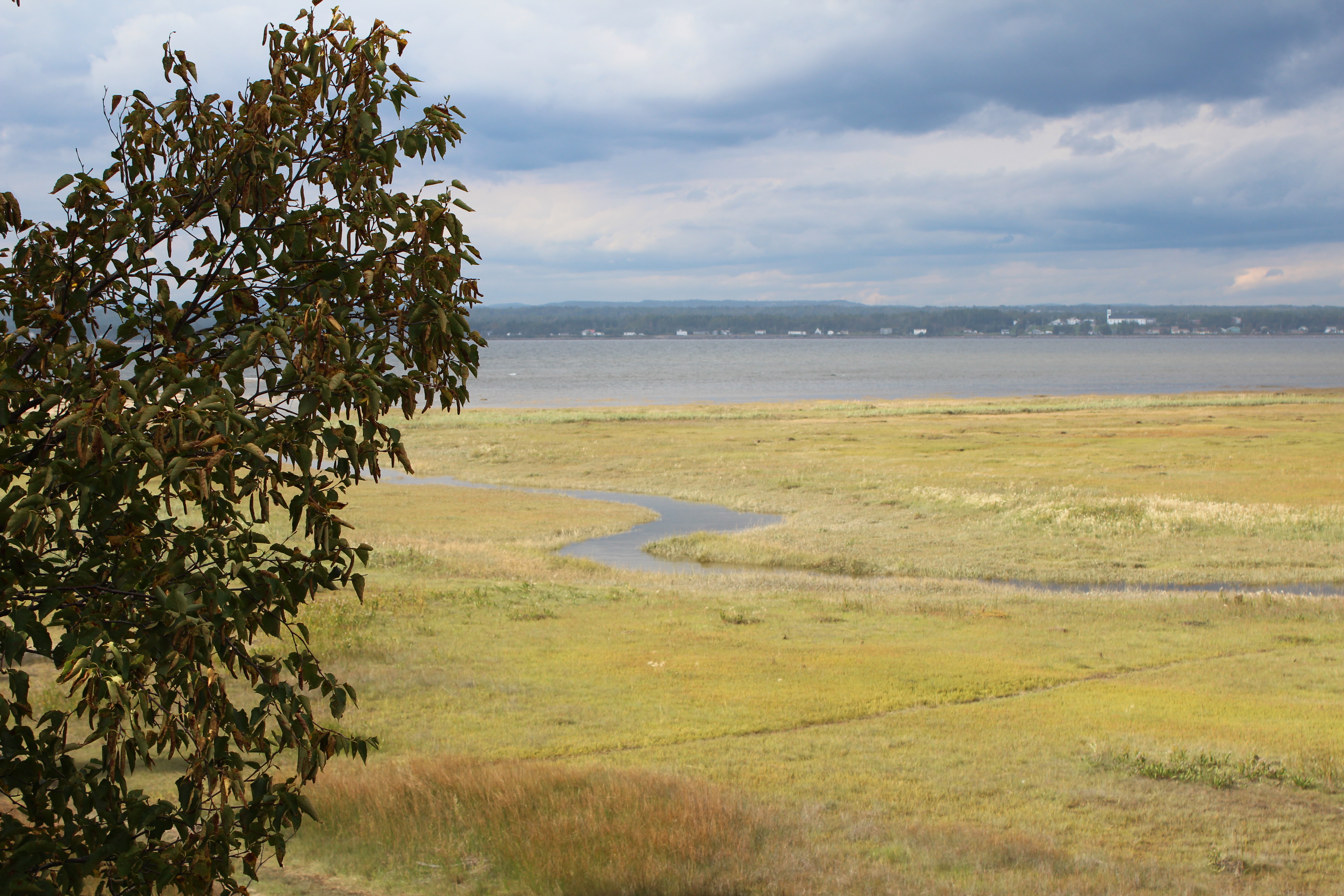
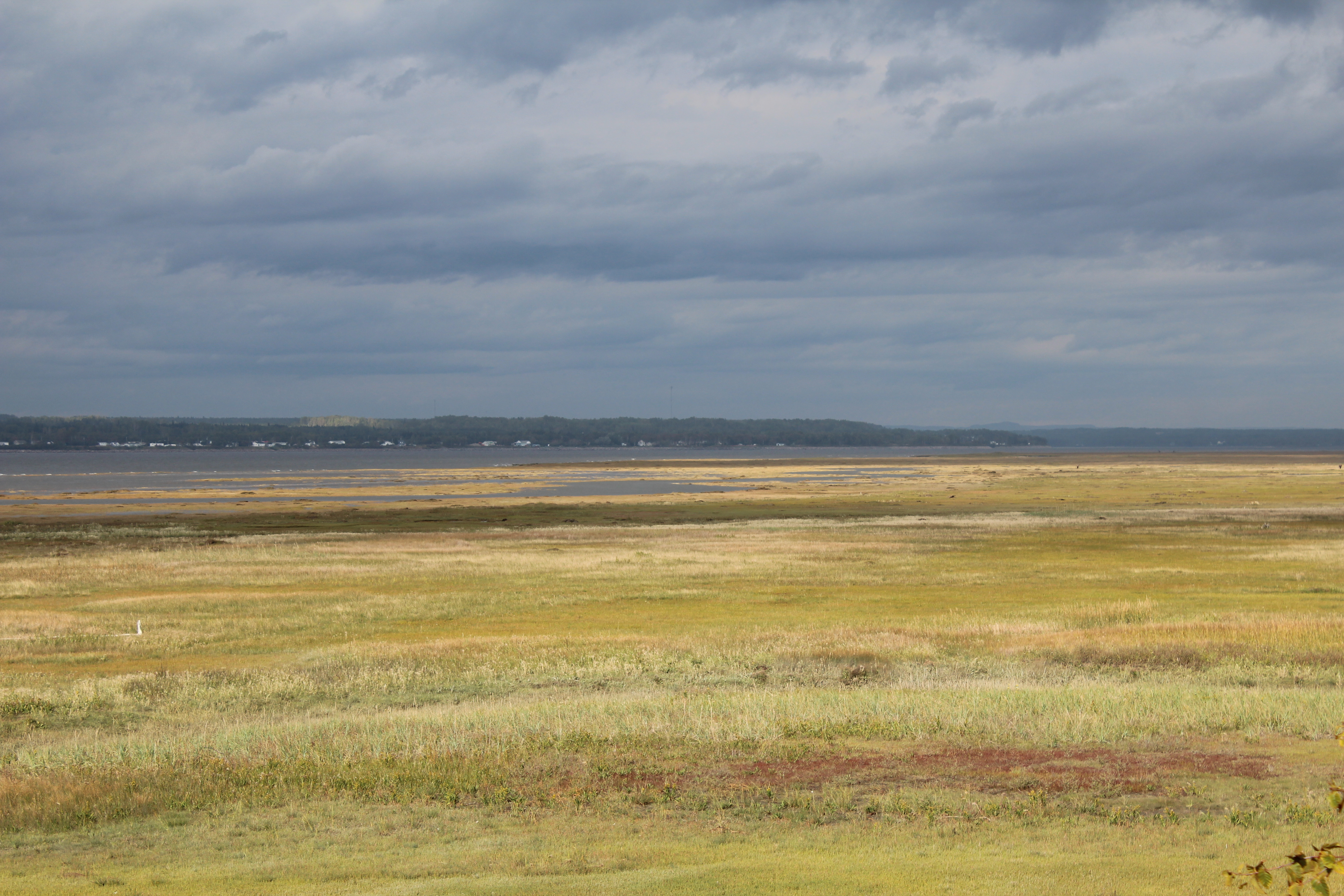
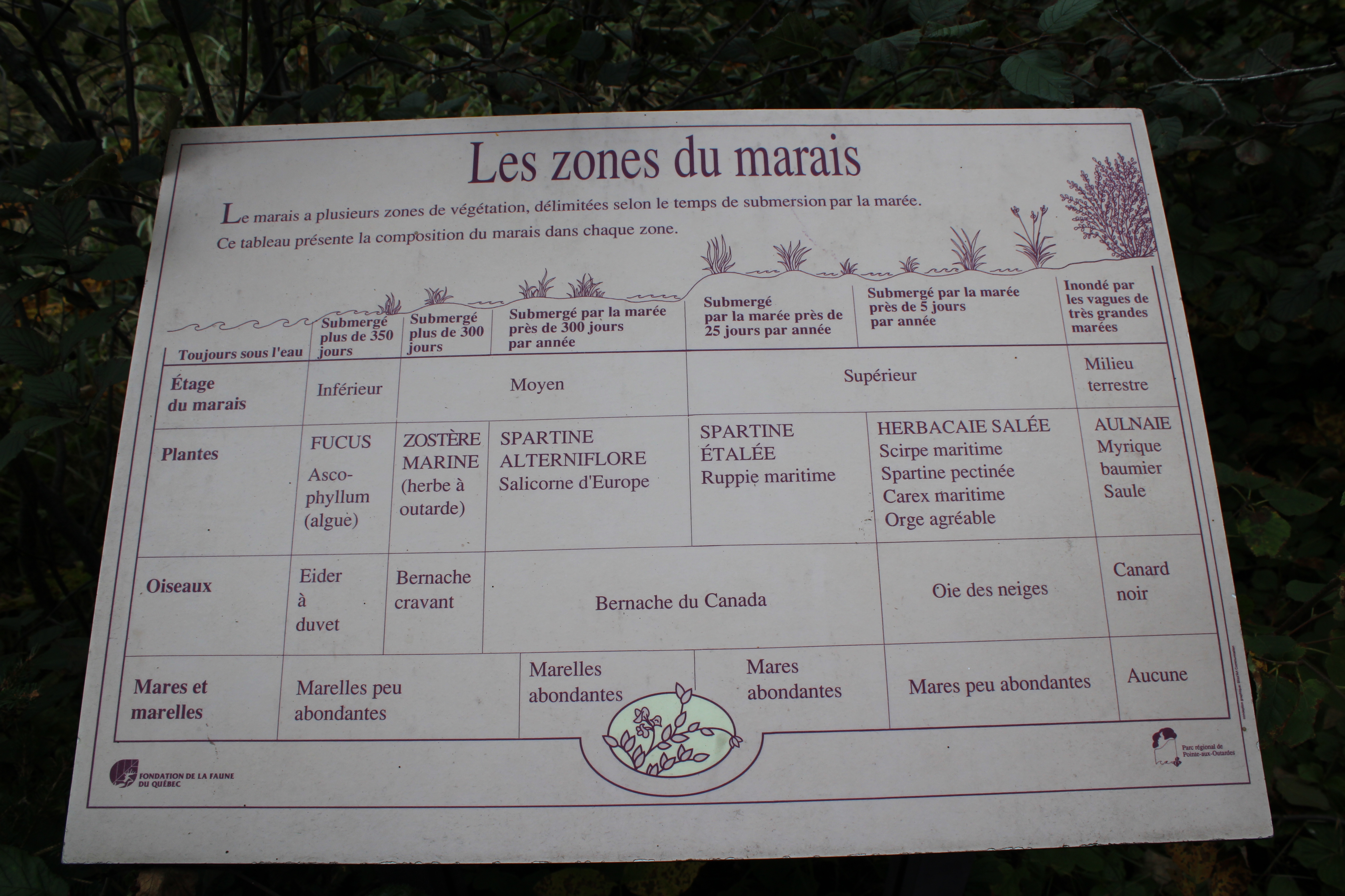
Jane again: After the dinosaur experience we were giddy with the ridiculousness of it all! From the ridiculous to the sublime as they say… we spent an afternoon in Pointe aux Outardes. All of our bird-watching friends take note of this place name. It is only 2 hours from Tadoussac and apparently there are 240 species of birds. During migration it is considered the top bird watching center of the entire province. As you drive along the road out of Forestville you immediately start to see a large peninsula in the river. This is the Pointe. Much of the Pointe area is a well-developed nature reserve. We took a short 3 km walk that takes you through 5 different ecosystems and we arrived just at the right moment – as 2 busloads of middle school students were leaving the park!! There is a massive salt marsh which is the primary area for observation of migration hoards of snow geese, Canada Geese and myriads of other ducks. They also claim several species of hawks and kestrels. I even took a picture of a hawk of some sort but I am so pathetic at identification, and quite frankly at bird photography, that you will simply have to take my word for it. They also had low sand dunes and beaches , multiple historic plaques and geological descriptors and it was a thoroughly pleasant way to pass the day. We spoke to the rangers and the area is open for cross country skiing in the winter so we may just go back. It looked like a pilgrimage for bird watchers to me. And there was a very cool looking B&B nearby. For those of you that frequent Tadoussac’s Petit Marché every Saturday you will remember the Ferme Dalpalou which sells beautiful wool. Their farm is on the road into the Pointe (so yes, they travel more than 2 hours every Saturday to be with us). Their farm was small but spectacular with a vista onto the water beyond compare. No wonder the wool is so special if the animals have that view all day long!


We spent a night in Godbout just outside Baie Comeau. We stayed in a great Auberge aux Mille Pêcher which was owned by a M. Beaulieu who has travelled the world, lived in Montreal for as long as Alan and I did, and chose to make a big life change 3 years ago and move permanently to Godbout (you see there are more of us than you think!) The Auberge itself is a really old building which he is renovating and decorating with artifacts from his travels. Godbout is a fishing village and also has one of the big ferry terminals at one end of the bay and beautiful sandy beaches surrounding a salmon river mouth at the other. Not a surprise I suppose, but many of the villages we visited were located at the mouth of a river flowing in to the St Lawrence.


Close to Godbout there is a small village called Franquelin. Franquelin was more of a logging/forestry village than a fishing village. They had a re-creation of the original log town that existed but it was not open to visitors. We were quite disappointed by that as many of the museums or attractions had closed at the end of August. We asked a local man in Natashquan and he said that the government grants to help with salary support for summer employees are only granted for summer students and cannot be used to hire locals other than students. When the kids return to college the towns cannot afford to hire other workers. One crazy thing I saw at the side of the road in the village was a local “pure spring water source”. People were actually taking their big blue bottles and filling them at the source site.
Alan – Pointe à la Croix:
Never do this.
After that abortive attempt to visit the museum in Franquelin (closed for the season) we found what promised to be a hiking trail down to a place called Pointe à la Croix. The tour book said this point provided the best whale watching on the north shore, and knowing well our lovely picnic spot on the Saguenay also called Pointe à la Croix, I thought it would be good to see this one. There was no indication in the tour book how long this particular hike was but we had been driving along the sea shore before we got to it so how far could it be? Jane suggested we take some water along but I said not to bother, it can’t be far if they don’t even give the length. (You know where this is going…)
Thinking 1 k at the most we sallied forth with the dogs just loving it. Of course a hunk of geography described as a “point” does suggest that it would stick out a little more than the coast line. And if it’s described as a point on a huge river like the St. Lawrence then even an idiot might guess that it sticks out a lot farther than the Saguenay’s 100 foot long Pointe à la Croix or even than the larger Pointe Rouge or Pointe Noire. Add to which, when you’re in uncharted territory it wouldn’t hurt to bring water just in case, a little food even – I did pack a back-pack so why aren’t I using it?
These were the thoughts I had ample time to reflect on during the forty-five minutes of reasonably brisk pace that it took us to arrive at a sign that said “Pointe à la Croix – 2.6 kilometers.” This was the first and only mileage sign.
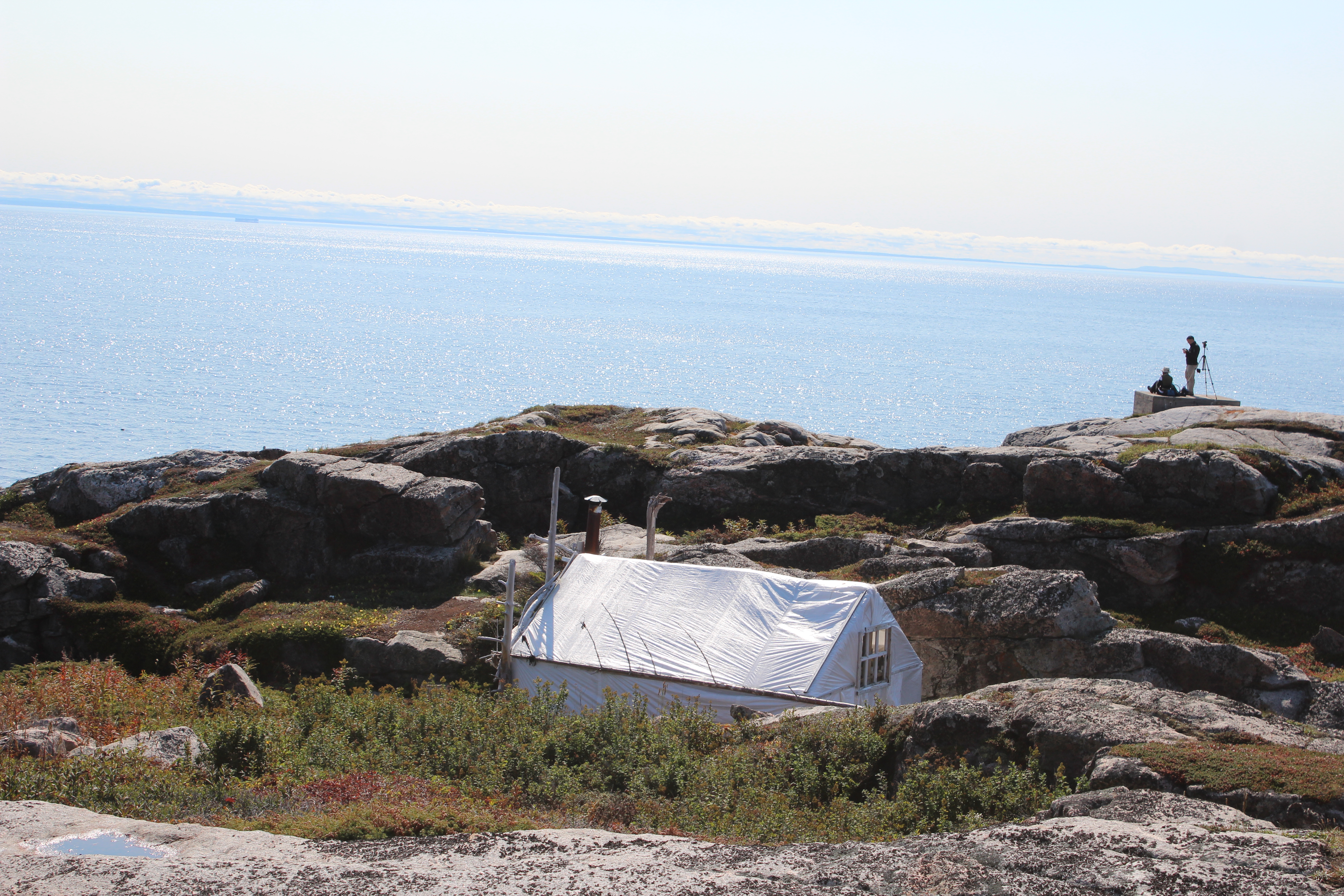
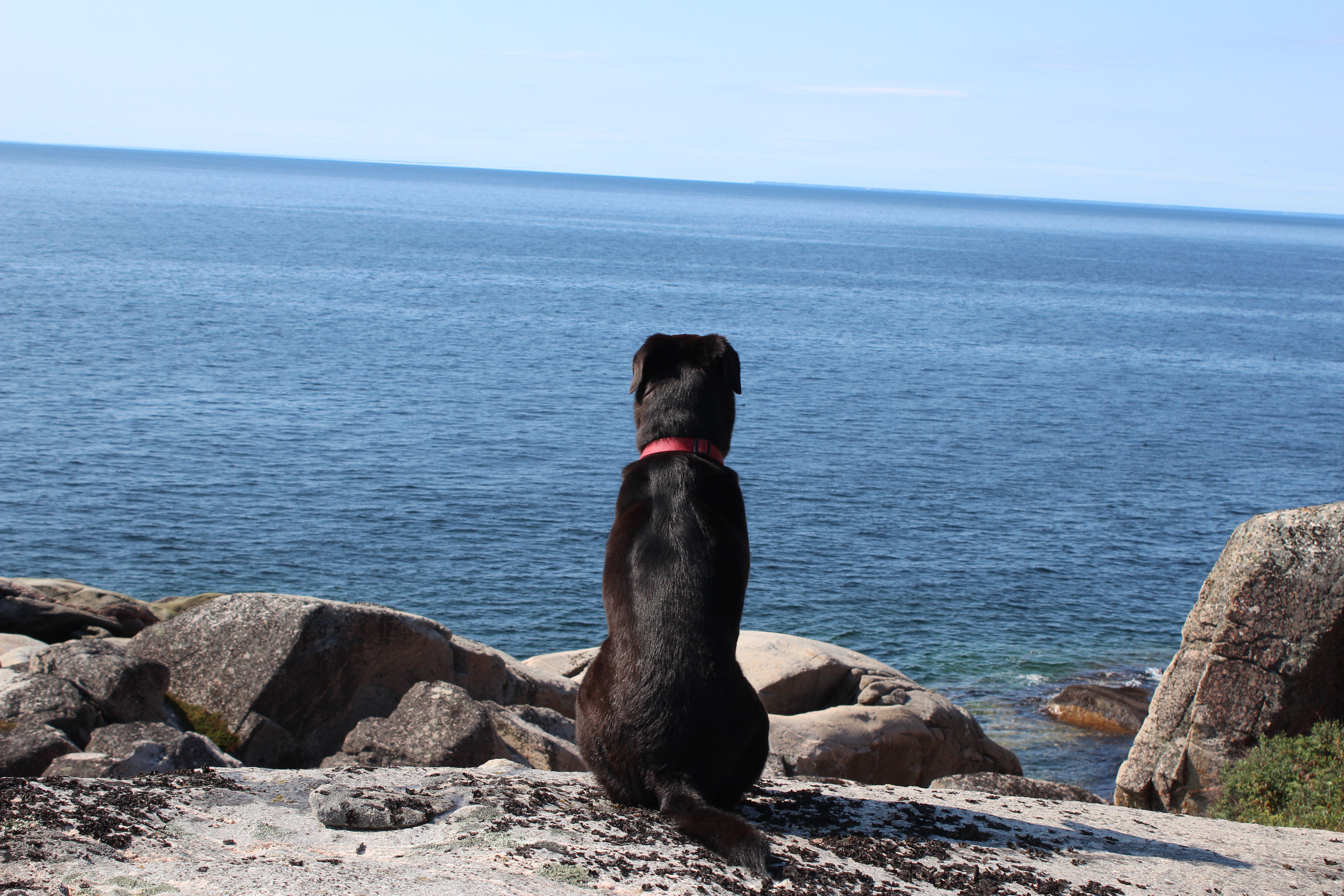
To her credit my valiant wife said to press on so press on we did. The country was beautiful – streams running by, the occasional lake, a very manageable path – until finally we emerged at the sea-side and a great big rocky bay followed by a huge Pointe à la Croix jutting into the flat calm Fleuve St. Laurent. There was a rather permanent tent arrangement thereon, and two naturalist-looking people out on the tip of the point with telescopes and cameras. Obviously this was a research project at work because it was the best whale-watching place on the North Shore. Jane suggested we stop short of their location for fear that these two devoted animal-loving science people were also afraid of dogs. Seemed a stretch to me but having nixed the water I thought it politic to keep my mouth shut.

Whales? Seals? A few sea-birds which weren’t that interesting. I’m sure there were whales there but they were all underwater. We waited for them to surface but I think they were hovering ten feet below the surface saying, “I can hold my breath just a little longer! Let’s wait till they leave!”
So we left.
It was a nice hike in the end. It just would have been nicer if we’d known we were going to be walking 5 Ks each way!
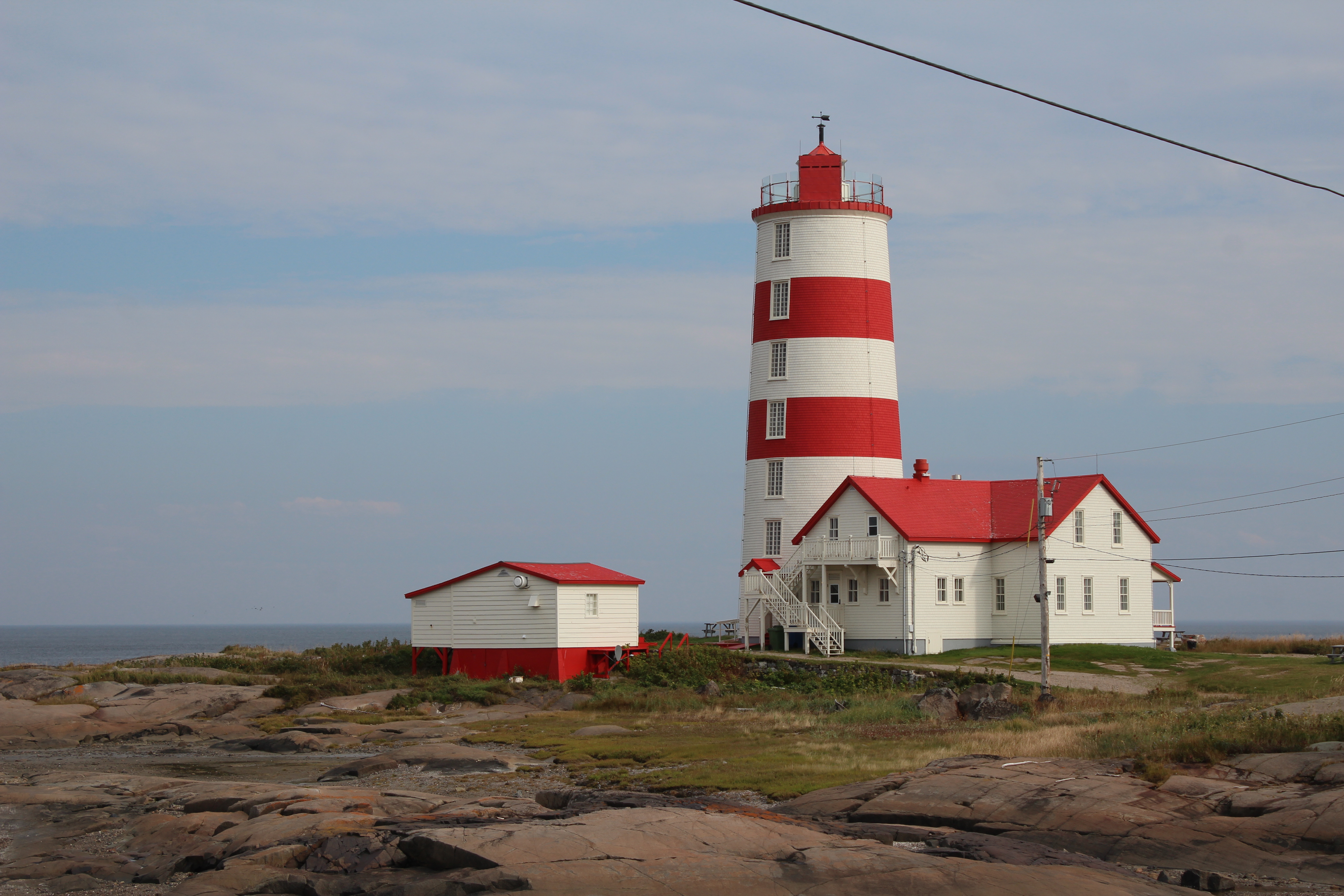
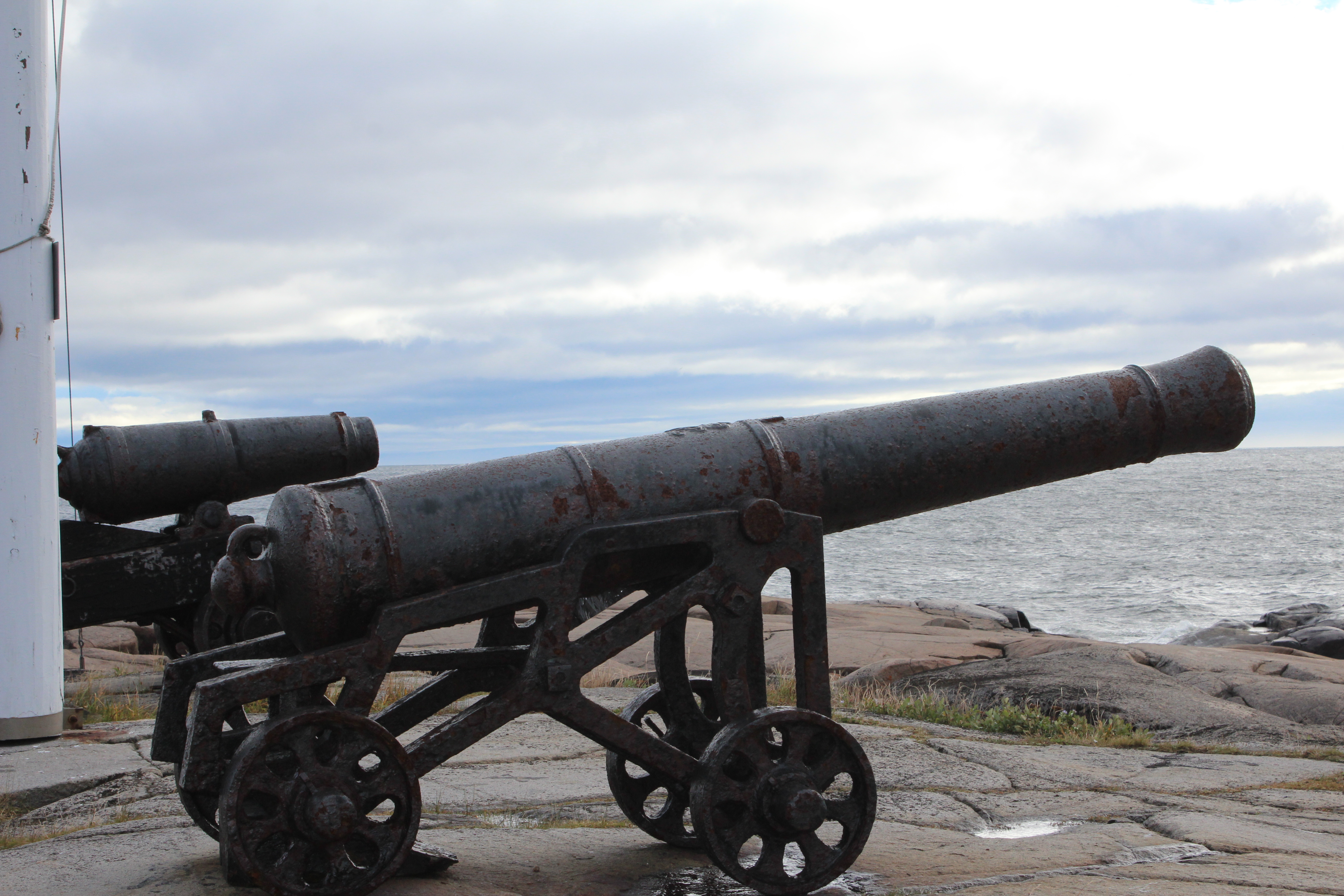
This from us both: Pointe des Monts was a very interesting spot with a well developed historical site related to the Lighthouse. On a map it is that central point where the shoreline turns abruptly north and because of that it is the place where the river officially ends and the Gulf of St. Lawrence begins. It is also a weather divider. The weather on one side of it is often remarkably different from the other side. The lighthouse itself is impressive and the light keeper’s house is well preserved. There were cannons out front on the rocks and we were surprised to find that in early days the keeper used them as a fog signal. In the dense fog he would ignite the two of them in systematic 15 minute tolls for as long as the fog lasted. Eventually more sophisticated steam fed horns replaced this system and finally radar and GPS took over. Just thinking of the keeper standing on this lonely, very exposed, rocky outcrop all night long in the fog and the wind to keep the ships off this enormous rocky point was humbling.

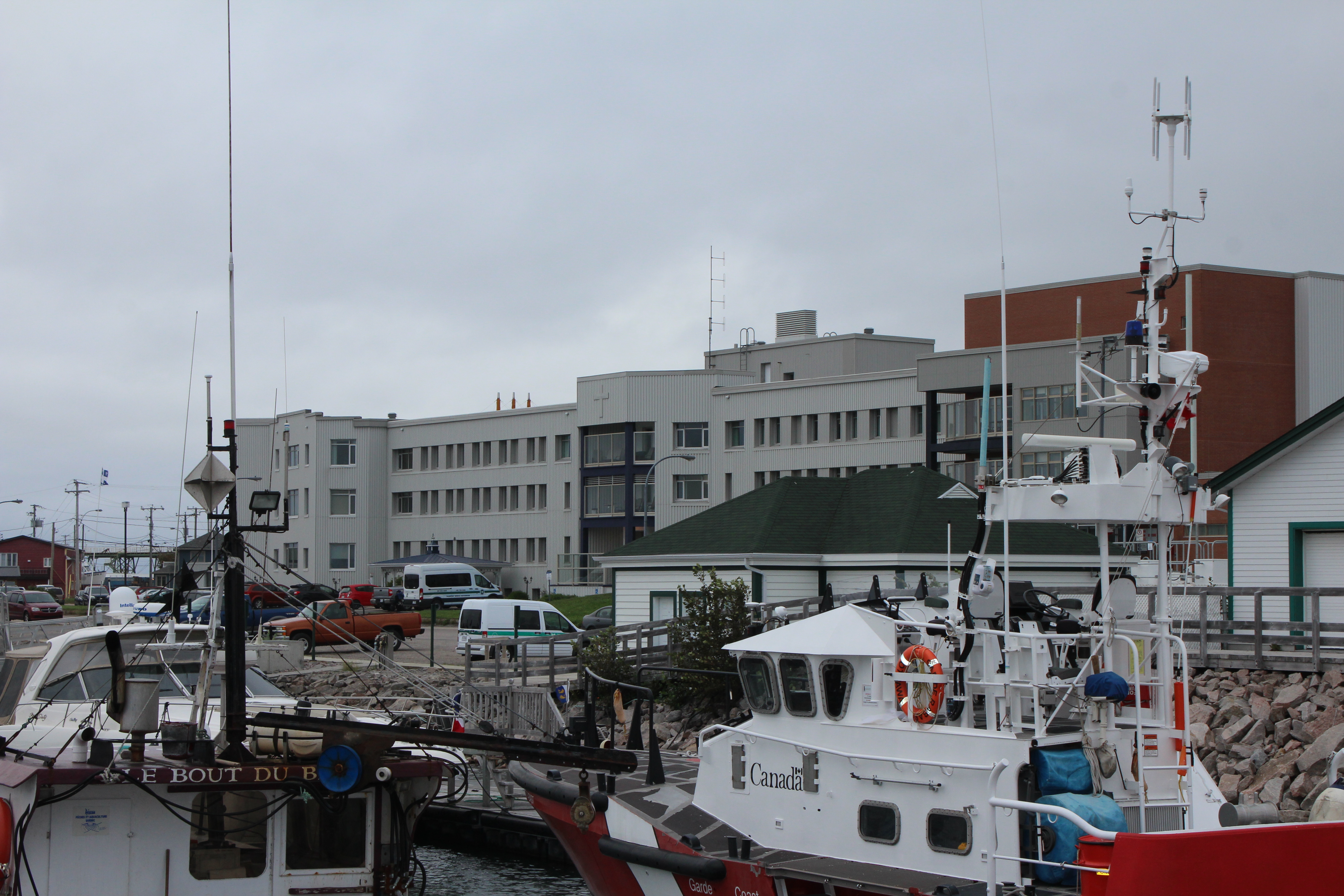
It is interesting how quickly we have become acclimatized to “living rural”. We love living in nature, the quiet, the beaches with no one on them except us, and meeting a few people here and there. We stayed in Sept Isles for one night and that was enough. We are kind of done with cities!! Sept Isles has done a bang up job of their waterfront. A beautiful boardwalk and park area next to an impressive marina filled with large sailboats. The harbour is surrounded by guess what – 7 islands and some are visible from the boardwalk. It is the perfect sheltered harbour because of these islands. The deep water seaport at Sept Isles is second only to Vancouver in terms of yearly tonnage. The growth of the city was pushed by the burgeoning iron ore business. As this business has slowed it has had a depressing effect on the city. A new large Aluminum processing plant has restored many jobs in the area.
Sept Isles is the last city of any size (25,965) and is a hub where planes and trains (575 km to Schefferville) go north to transport goods and people, and ferries transport people and vehicles along the north shore. We were very impressed with the strong presence of the INNU. There are many rivers, and small villages named in the Innu language from Baie Comeau onwards. The Innu (from my limited research at this time) were formerly known as the Naskapi-Montagnais whose home is the Quebec Labrador peninsula and they are approximately 16,000 strong living in 11 communities in Quebec and Labrador. In Sept isles there were parts of the city where the stop signs were in French and Innu. Pretty impressive when you think about how militant the government is about no language other than French!!
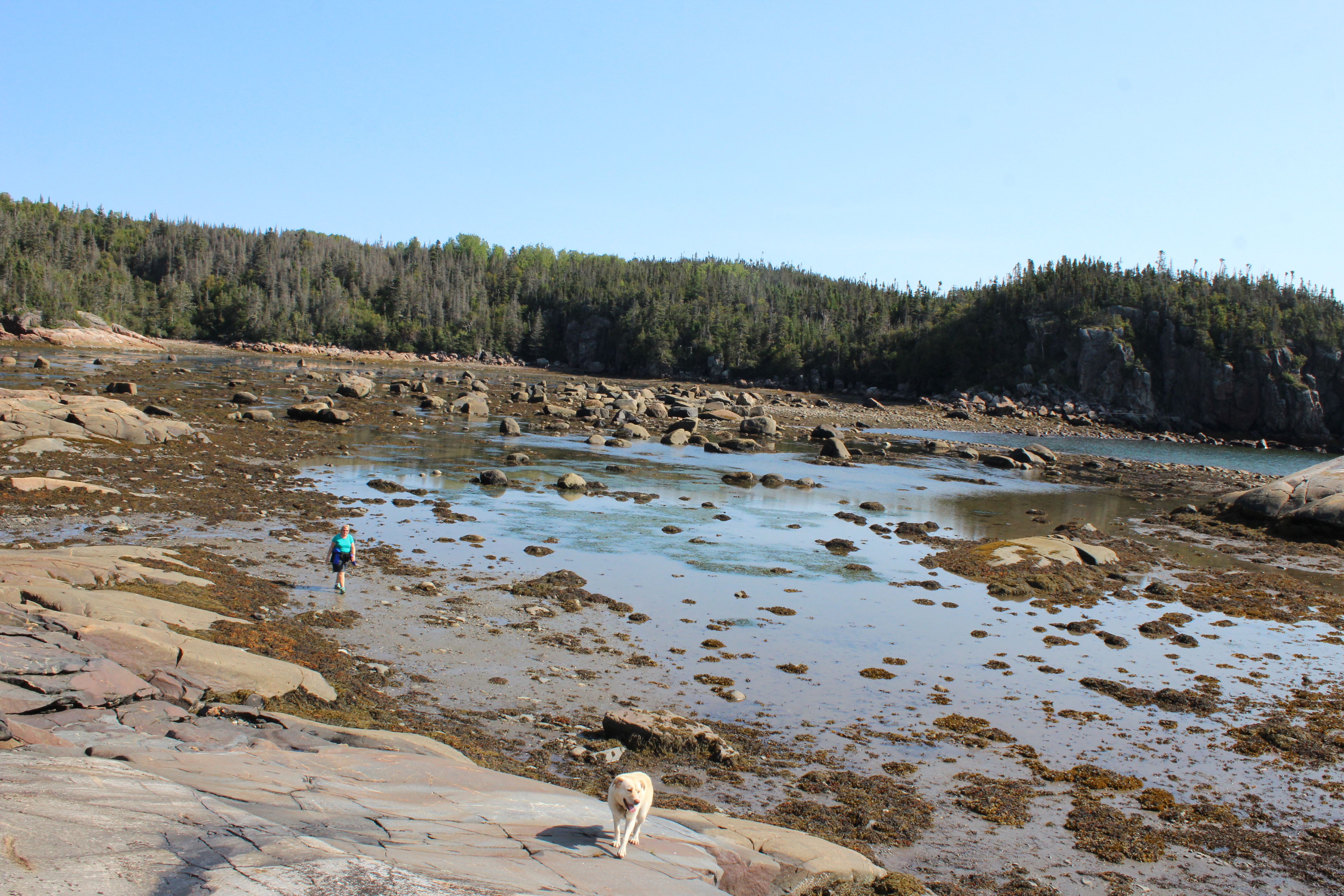
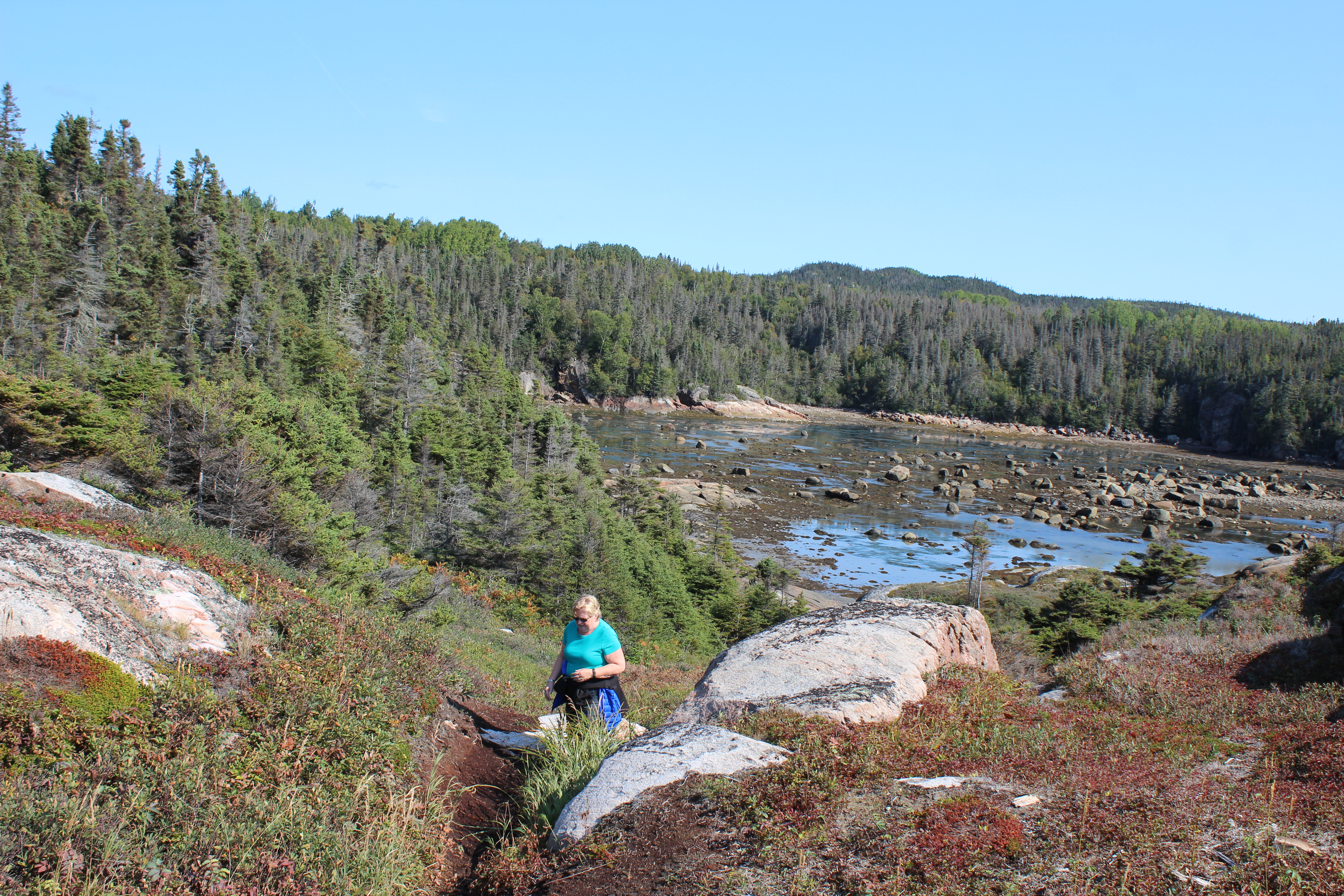
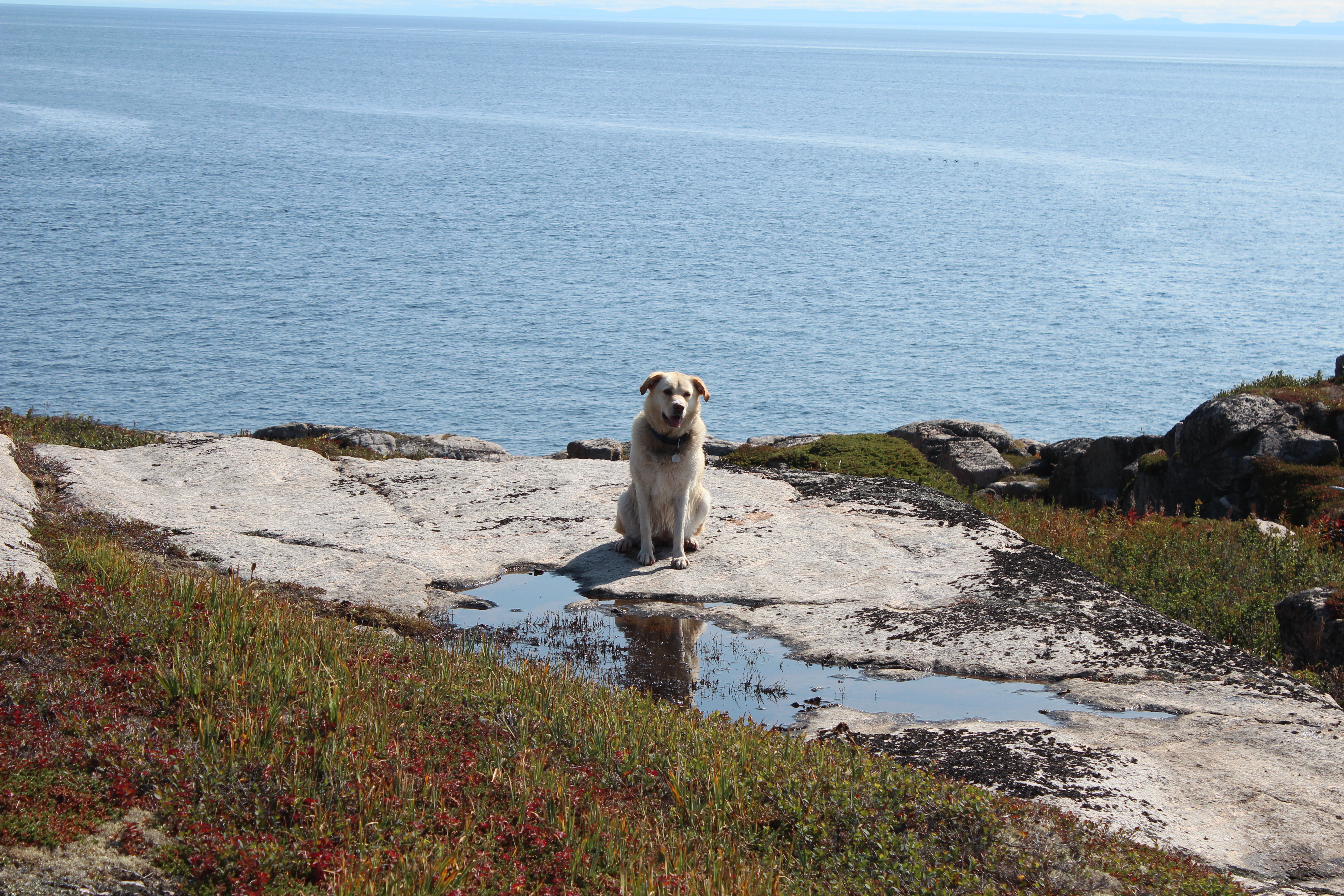
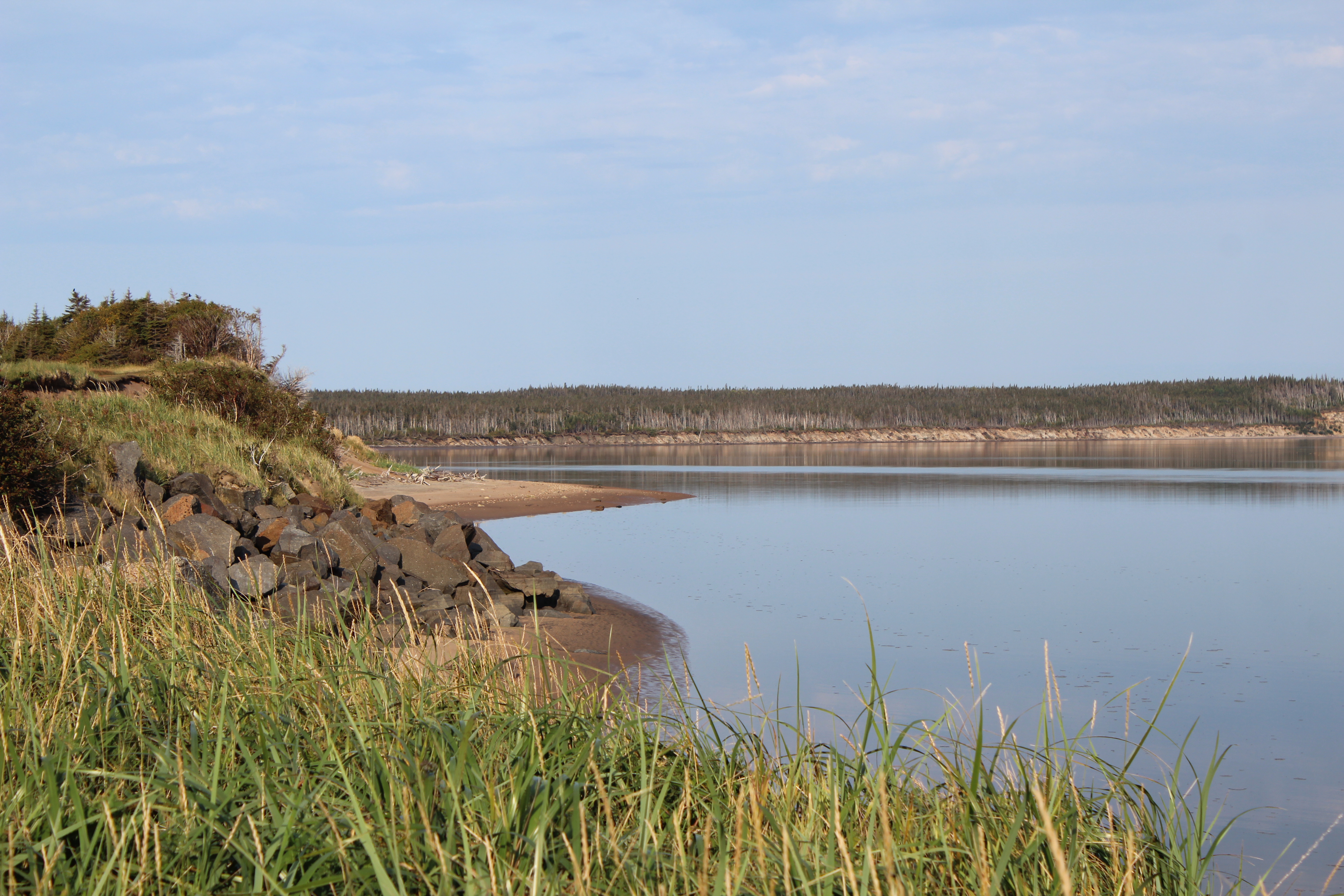
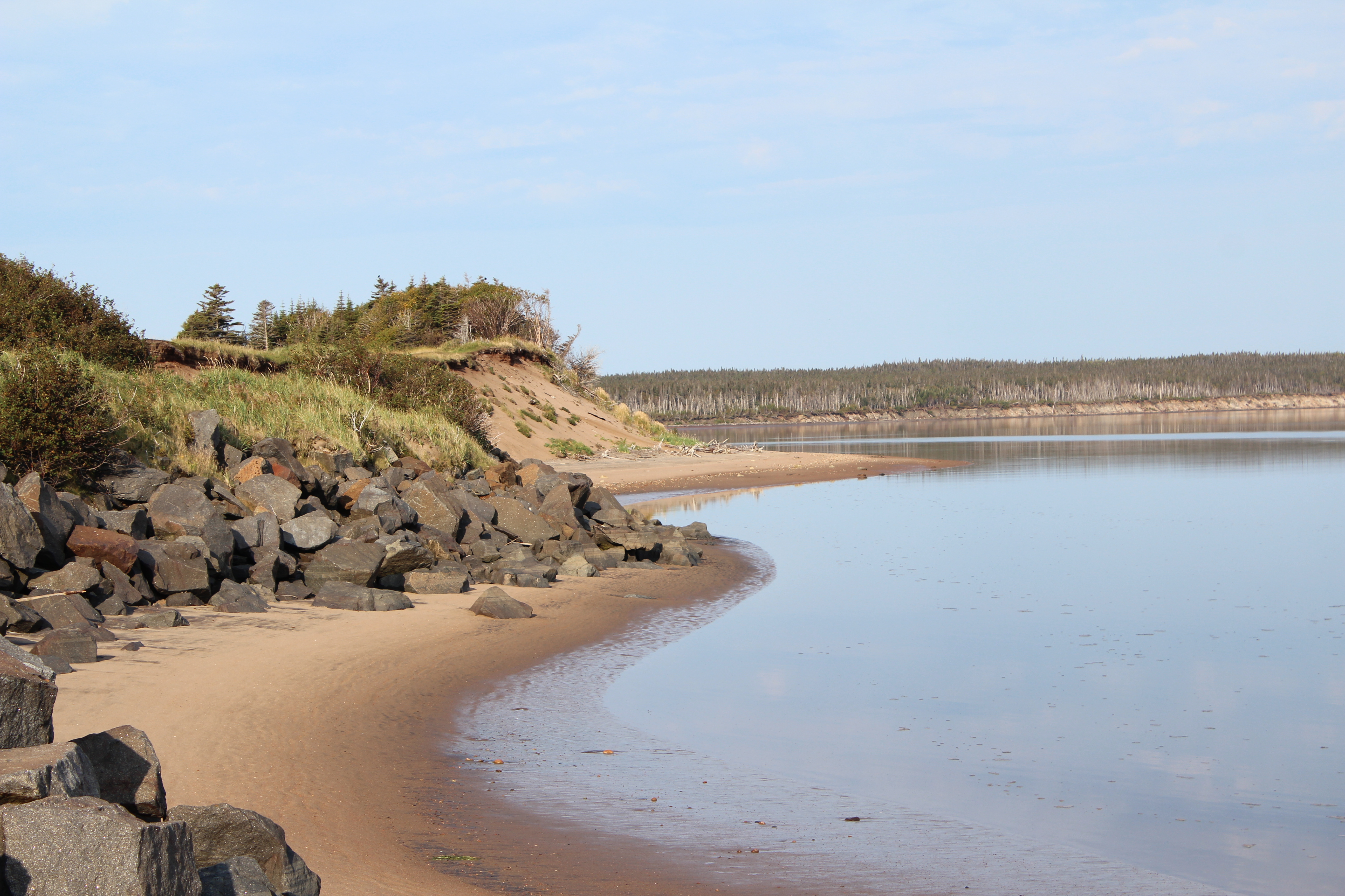
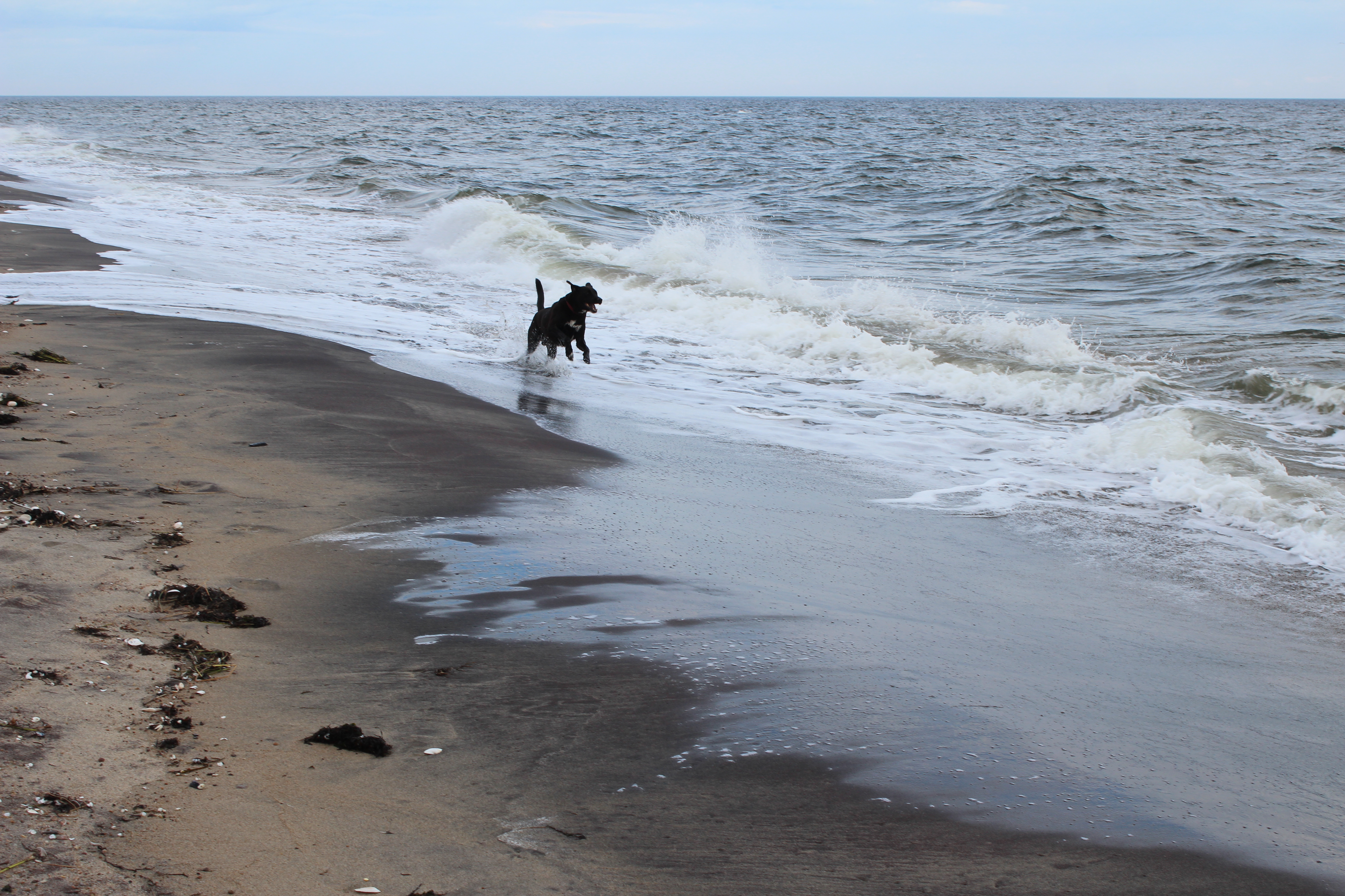
We tramped the beaches and the bays in several small villages along the next stretch of coast line (Moisie, Gallix, Magpie, Sheldrake, Longue Pointe de Mingan). Each unique bay seemed more lovely than the last. Most were at the mouth of a river, some with as few as twenty houses. The populations ranged from 110 to about 3-400 people. We stayed in B&Bs mostly and there was usually one restaurant open in the village to serve the final straggling tourists like us. But you had to be smart – there are no casse-croutes between the villages and certainly no gas stations. In places there were signs that would tell you how many miles until the next gas station so you could check before passing by. Staying in B&Bs is an advantage as breakfast is included. We took a cooler and had a picnic lunch each day which gave us the luxury of eating whenever, and wherever, we wanted which was usually on some amazing beach watching Shannon run like a nut in the waves and Ella scrounge good crap to eat.


A few villages like Rivière de Tonnerre had a huge church in the center of their small community as well as a primary school. The story in this village was that at a time when the fishery was almost dead because the porpoises were eating all the fish, the priest of the church worked tirelessly with government and community to find other industry for the area and became a much loved and respected member of the community. Nice to hear something positive about the church once in a while!
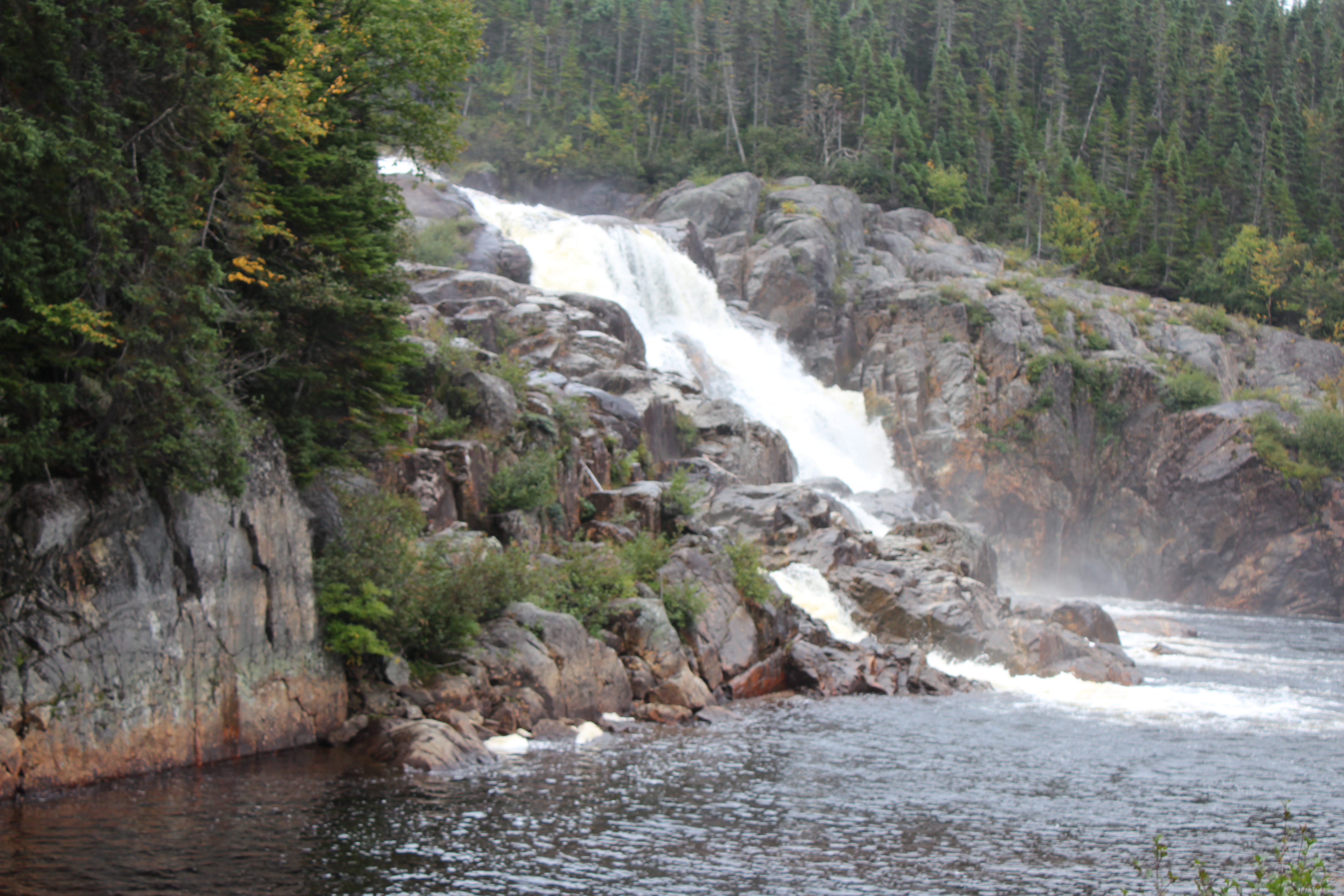
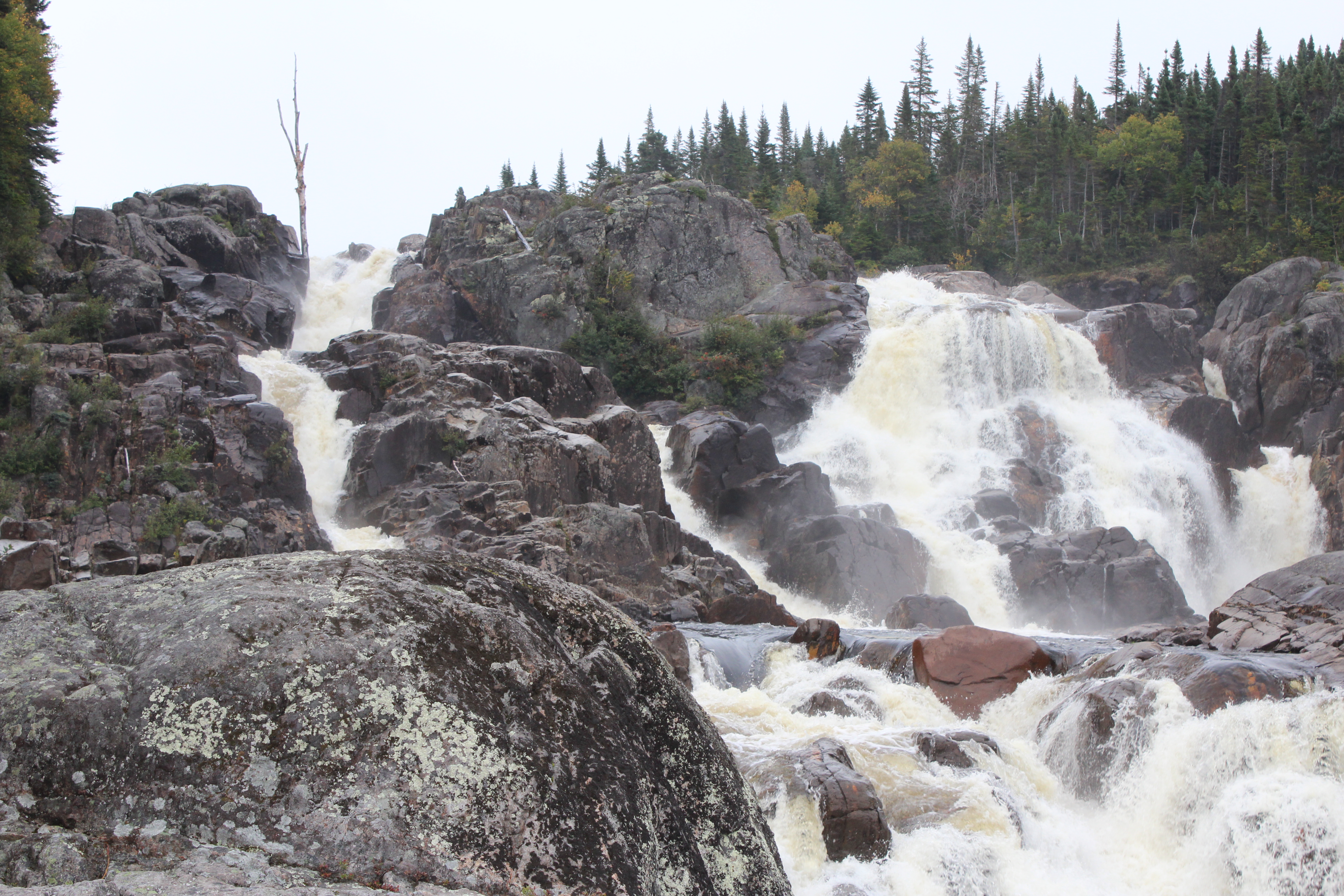
In Rivière de Tonnerre we almost missed a sign for a waterfall and managed to find both the small and the larger falls on this river. We drove about 8 km off the road and came finally to a small innocuous sign that said trail to falls. We followed what turned out to be a boardwalk type of path through the woods ending at a beautiful falls.


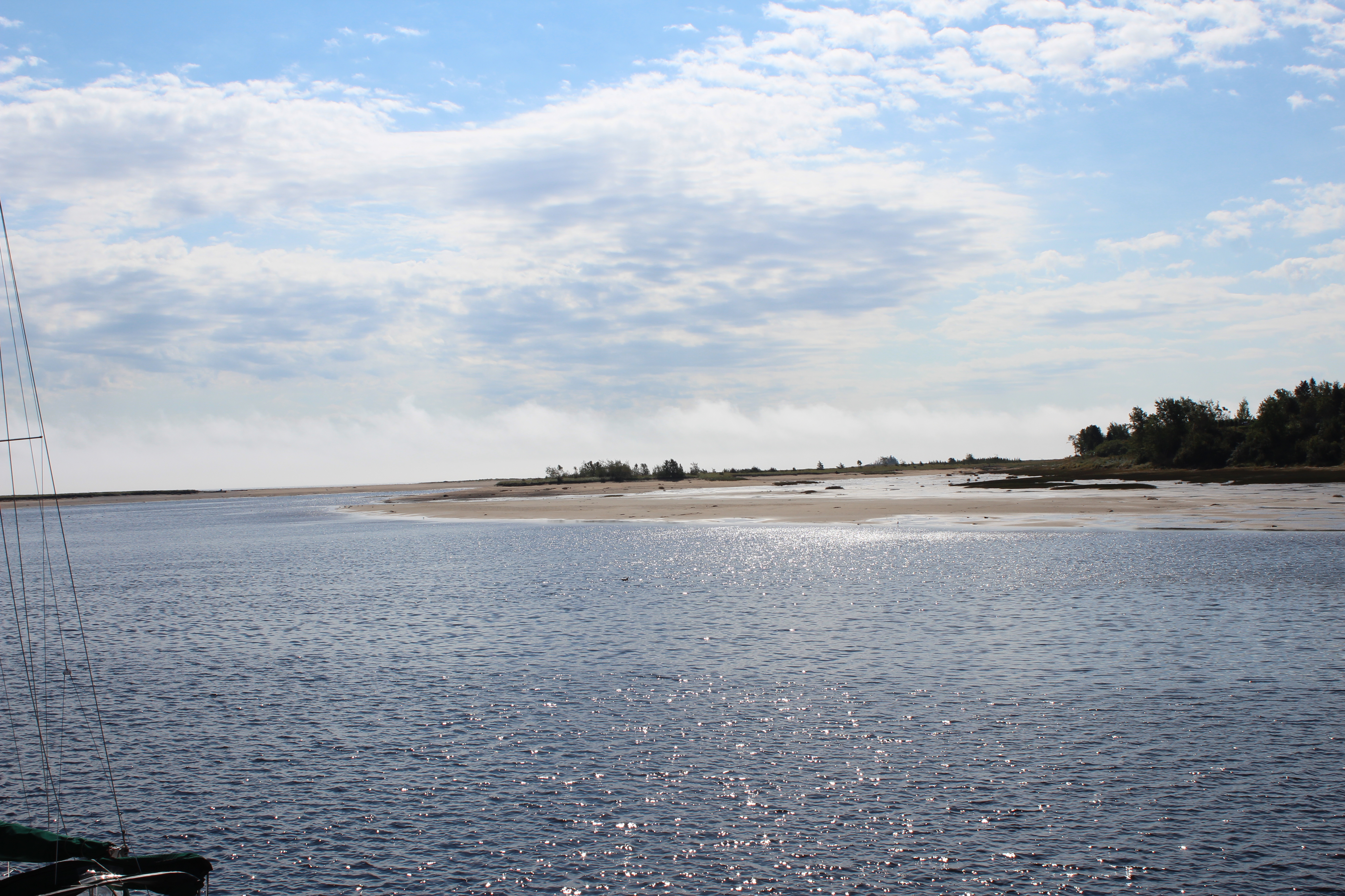
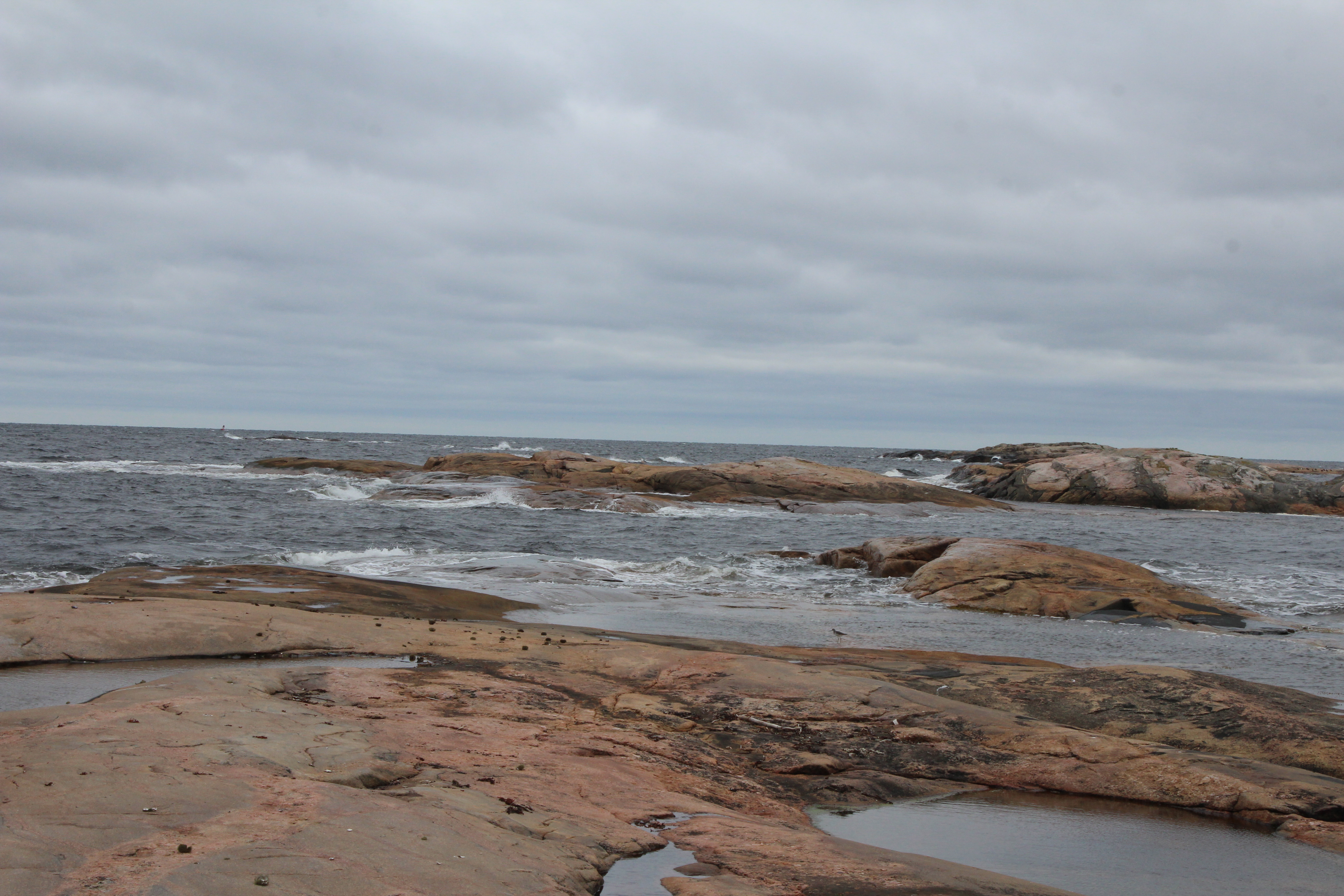
All along the drive you are able to see across the St Lawrence to the Gaspé even though we were now in the Gulf. At this point that disappears and it is really big sea! You don’t see Anticosti Island just water! We are now in the area of the Mingan Archipelago which stretches about 175 km. We would have loved to explore the Mingan Islands and there are several boat operators from the Innu community of Mingan who take cruises out but with the dogs this was impossible. The dogs are not allowed on the boats or the islands many of which are bird sanctuaries. What is the real drawing card are the monoliths of stone which tower over many of the islands – next time.
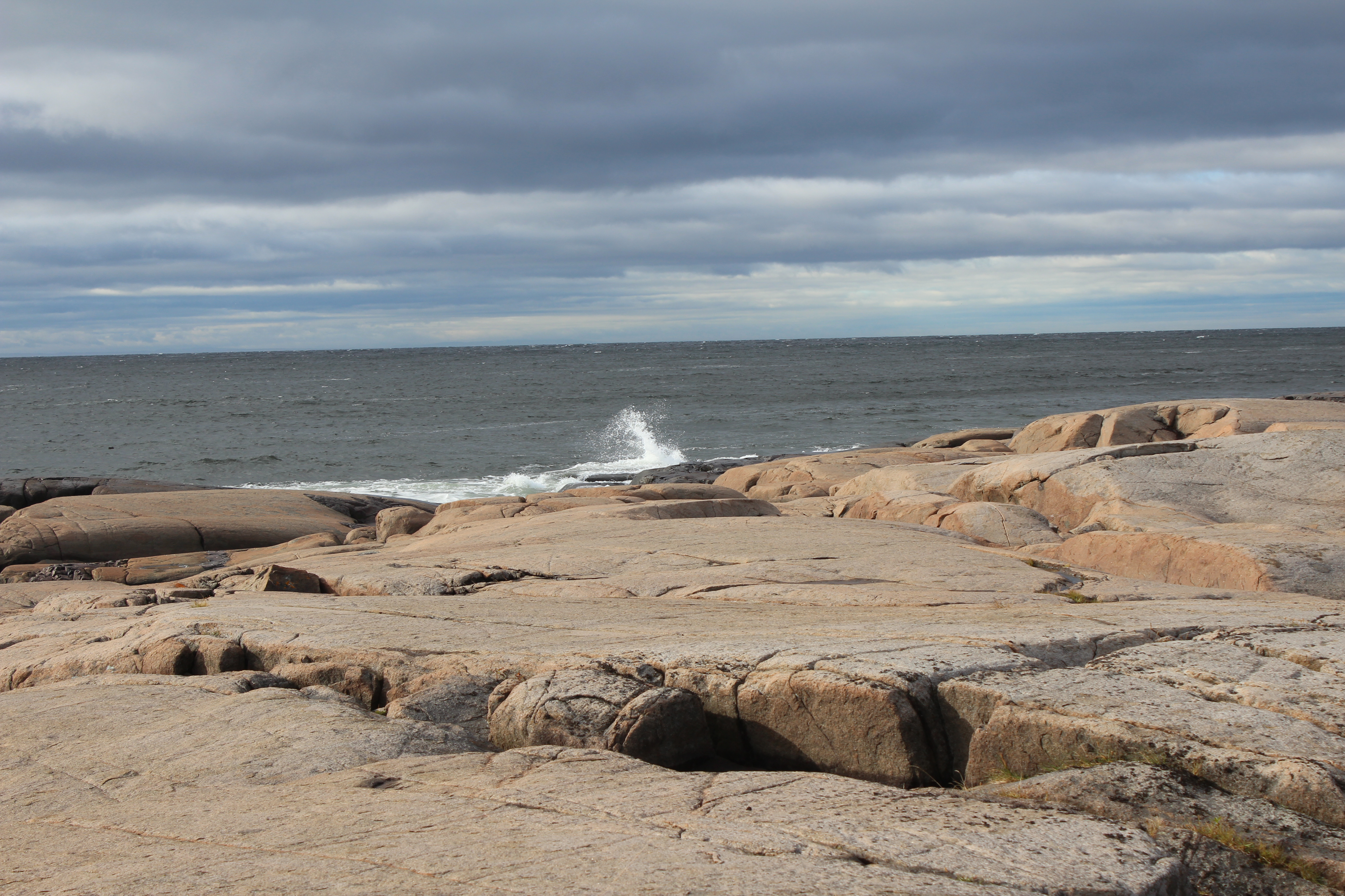
Havre St. Pierre (population 3,515) is a lovely village with a huge bay. This was our one wild wind day so we spent the better part of the afternoon walking the wild beach with the waves crashing – lots of fun. What I really liked was that the small hospital was right on the bay overlooking the water and the marina. Surely that would help people to get well just being able to see the sea!!

After Havre St Pierre the villages become farther and farther apart. Explorers from many countries France, England, Holland and Belgium came to find furs, to fish and to establish communities. We came across a bay called Baie Johan Beetz . The story goes that after his fiancée died of pneumonia in his native Belgium he wanted a change in his life. He learned from friends of the North Shore and its hunting and fishing and came to Quebec in 1897. Johan was a Belgian naturalist interested in the way of life and the livelihood of the natives and the villagers who had established communities in the region. He learned to survive in this harsh environment and to trap with the villagers. He knew from a business perspective that a small place like this would need something to distinguish them from others if they were to remain a sustainable village. He recognized that one of the most prized furs were those of the silver fox. This area had an abundance at that time, and he developed ways of raising the foxes for their furs thus staving off the elimination of the species in the area as had been the case with so many other fur bearing animals in the region. He married a local woman and they had 11 children. From 1903-1913 he was the postmaster and even part time doctor who was credited with saving the village from the Spanish flu (1918-1919) by limiting external contact amongst the villagers and disinfecting all the mail!!! The village has preserved his house and created a park in his name to recognize his efforts on behalf of the village. He left the area and moved to Montreal and later to Quebec City. He continued to raise foxes on a farm in Vaudrueil Qc. for many years.


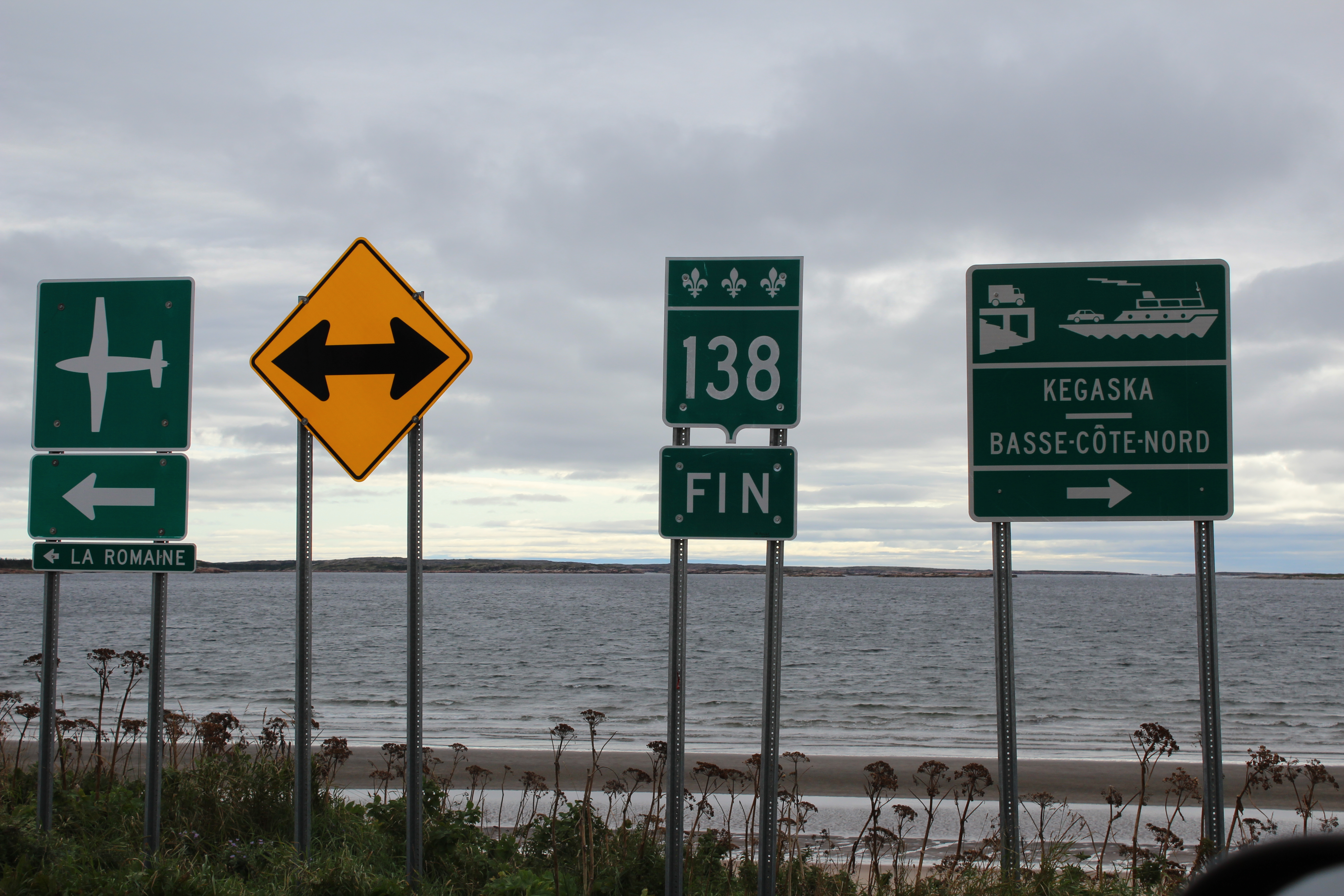
Natashquan in my mind was the reason for the trip. I am not sure why but I have always wanted to go to this village which until 2013 was the end of the road. In 2013 the bridge was completed that would open the road to Kegaska which Alan describes in the last section.
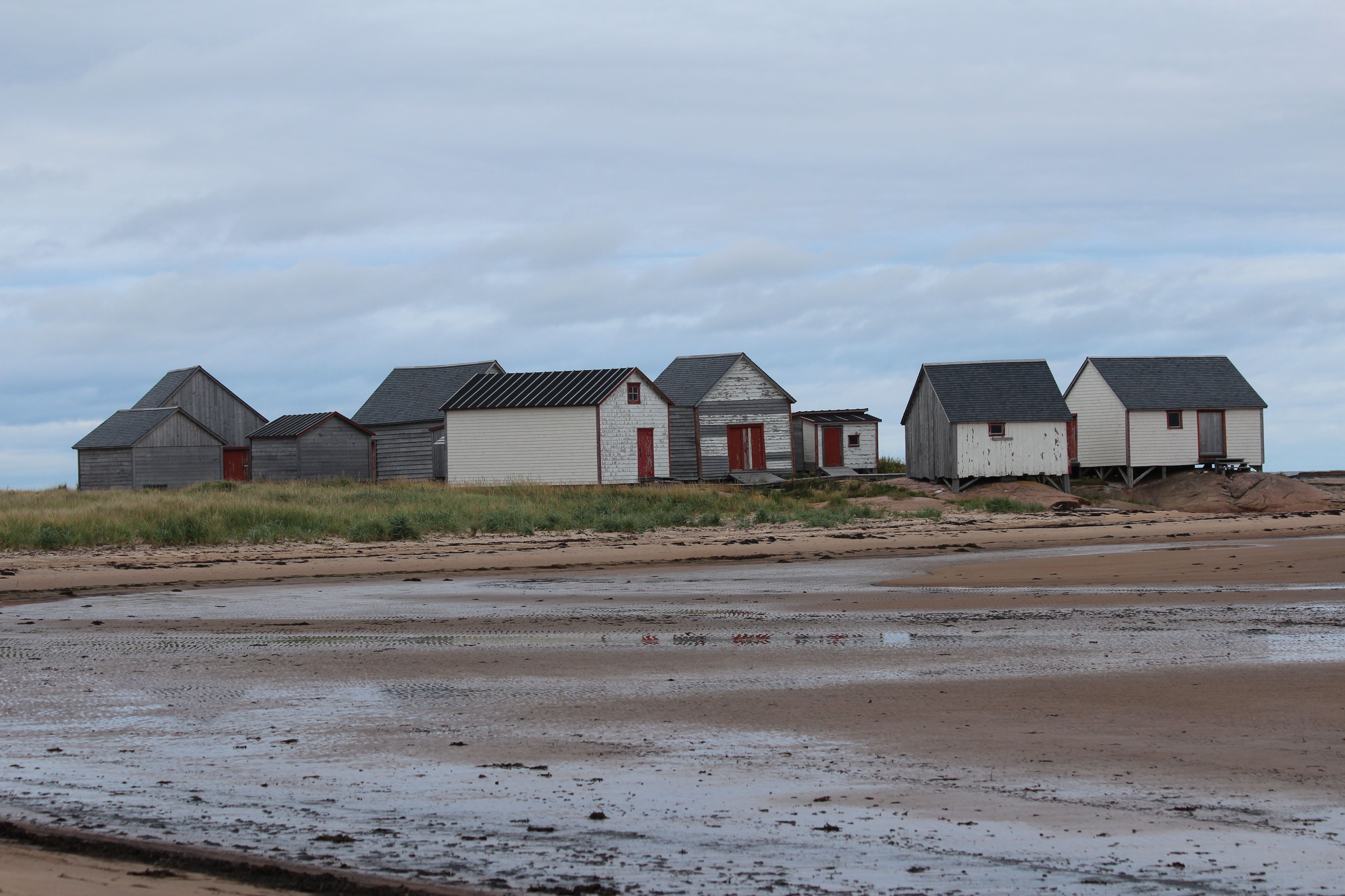
Natashquan is a village of approximately 250 people. It was, and is primarily a fishing village but it has also developed avenues to help visitors understand the regional history and culture. And they have an amazing restaurant run by two sisters that served us a great seafood supper. I would go back just for the food. In other villages we saw some fishing boats in the water but more on the shore as the fishing season was over. What we did not see was evidence of fish markets or processing plants in the region (other than Port Neuf sur Mer). Here in Natashquan they have preserved a site on the far peninsula of the bay which is called Les Galets. It is recognized as an historical site and has managed to survive 150 years of battering by the sea. It is a group of sheds that were essentially a village within a village. The sheds were in essence a market for all things cod fishing. Some sold fish, some sold fishing boats, some fishing equipment, others were drying or preserving sheds. They are considered a memorial to a way of life lost, and on the overcast day that we walked the beach they were a silent reminder of a different time.
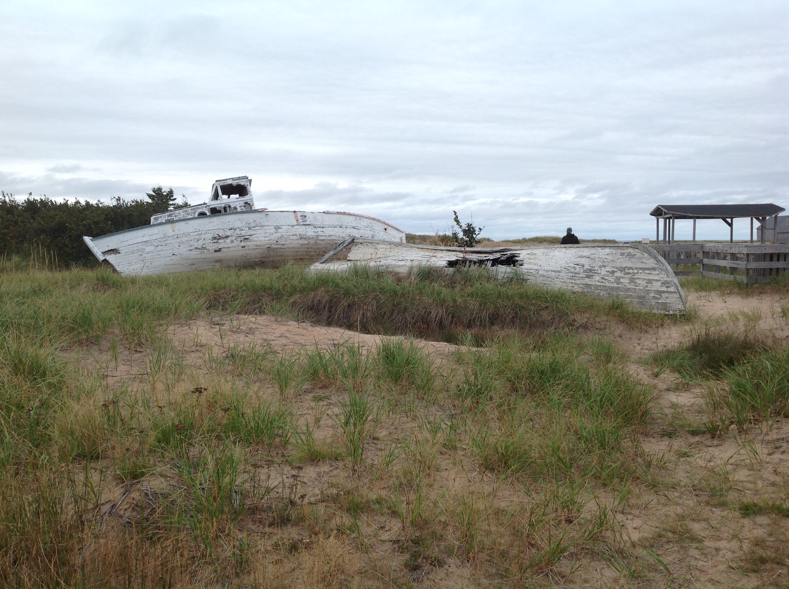
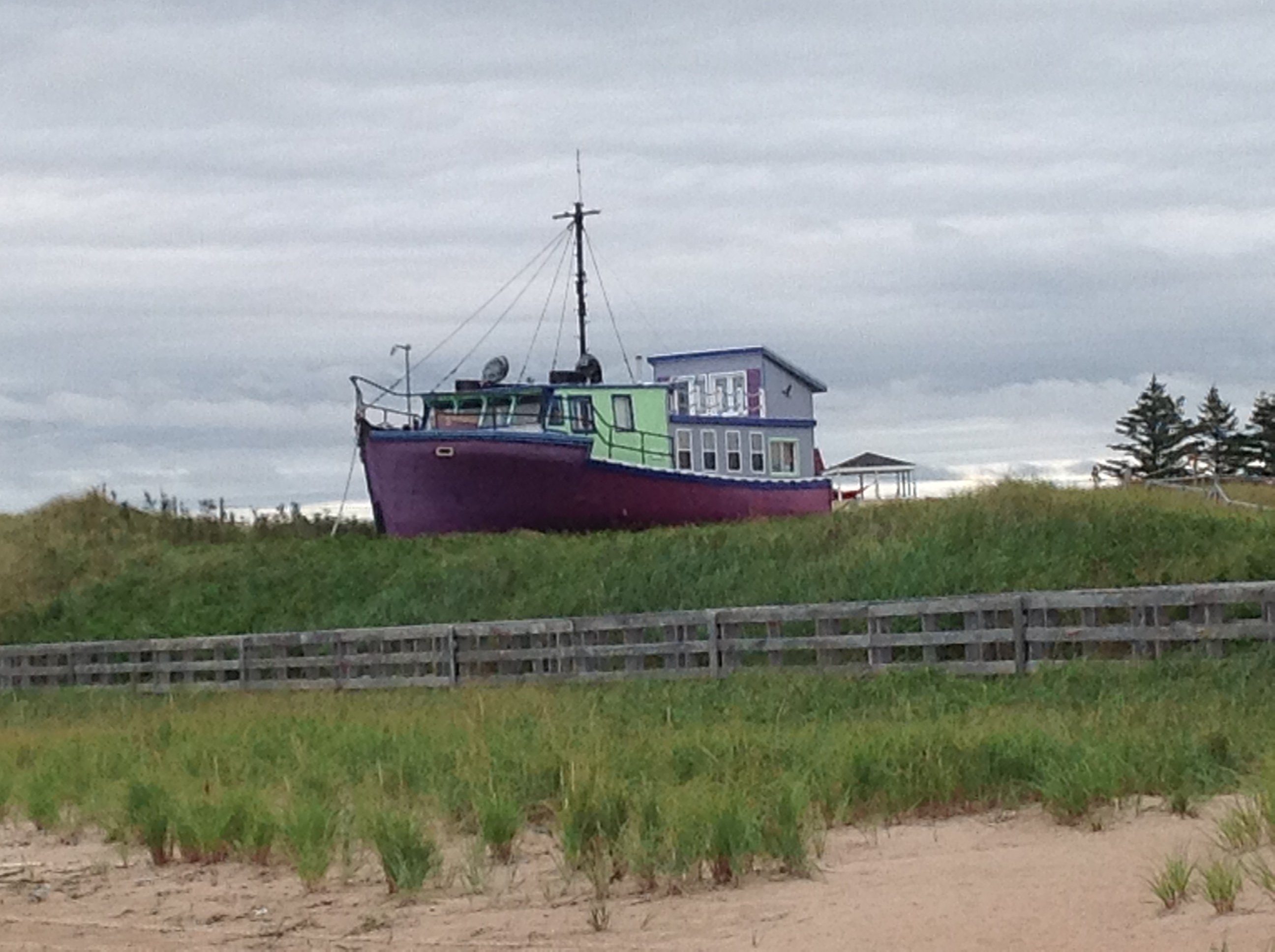
Alan loved the beach in Natashquan for a couple of other reasons. I have put the pictures below. You all know that Alan never met a wooden boat yet that he did not think he could repair and get floating again. He took a million pictures of two great “project” boats but his mean and nasty wife doused his dreams of glory and said “DON’T EVEN THINK ABOUT IT”. Someone with a truly lovely wife had converted his fishing boat into a summer cottage – alas Alan’s wife was not that lovely and again his dreams were dashed!! How very sad but time to move on to the last village!!
Kegaska: Alan
When you get to the end of the highway it’s hard to avoid the feeling that you’ve just arrived at the end of the world. Of course the world goes on but where there is very little traffic leading up to Kegaska there is none thereafter. People have stopped. From here it is boat or small plane to even smaller and more isolated communities further down the coast and further north.
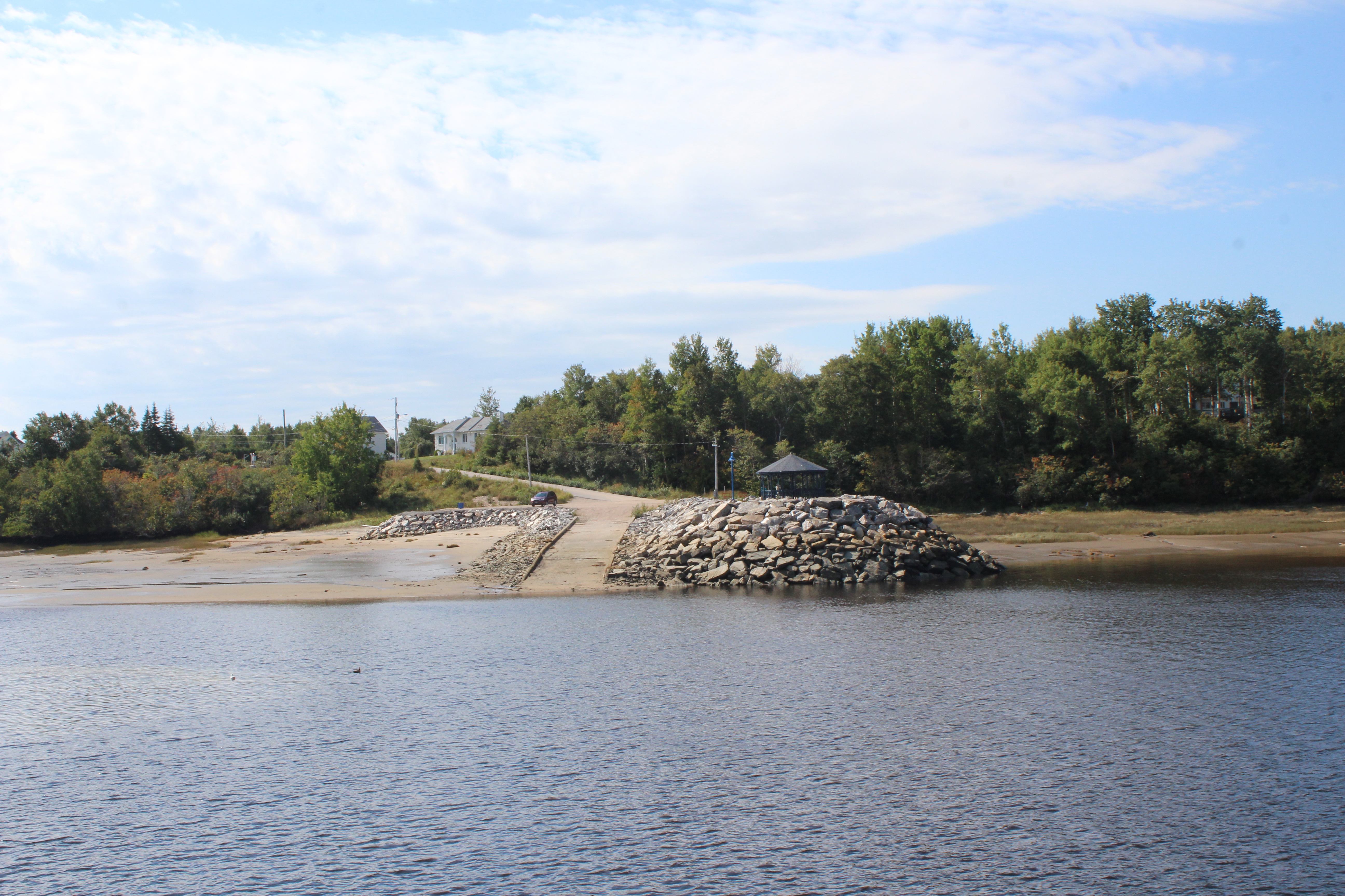
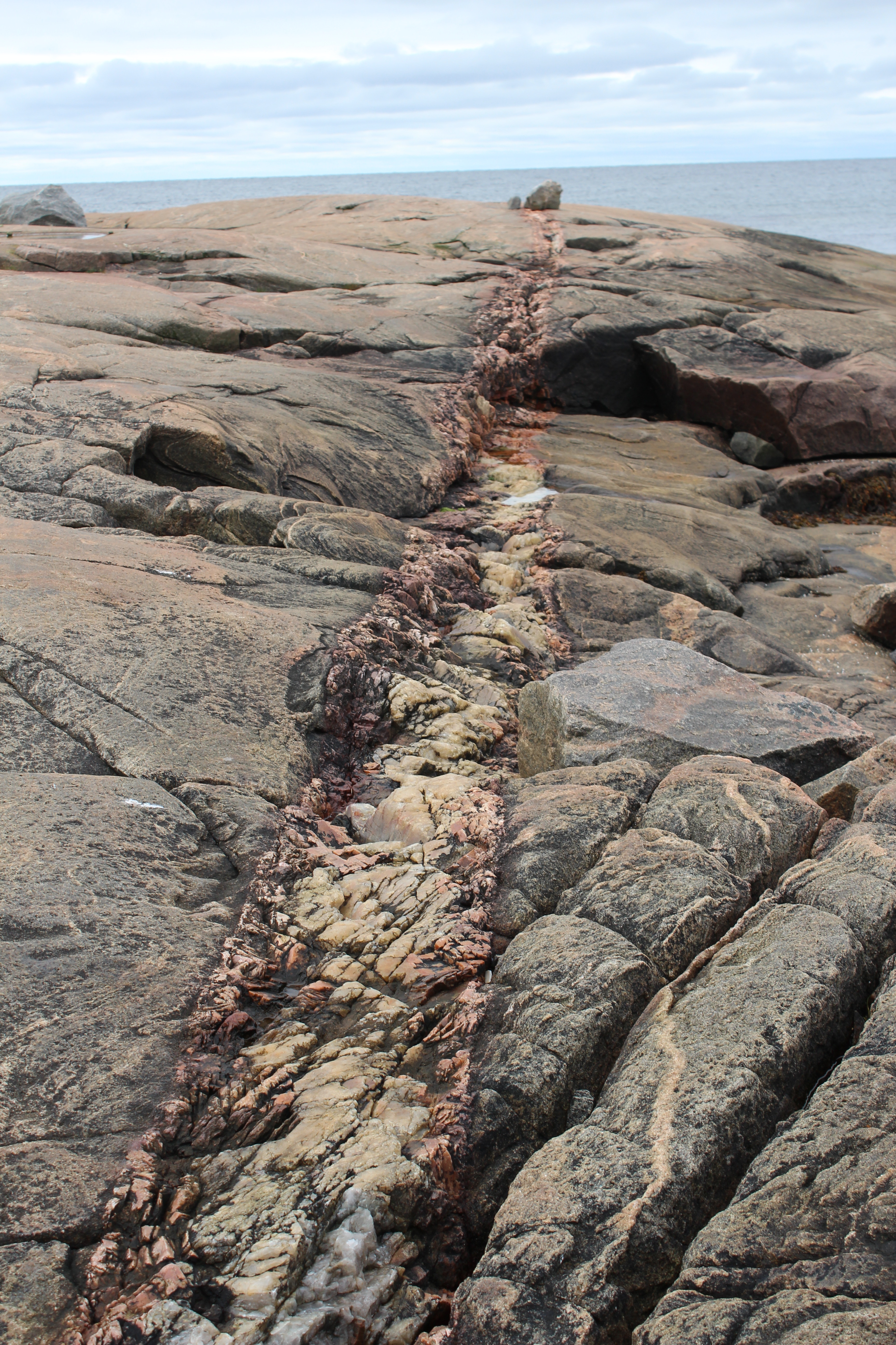
When God created Kegaska she had a pretty good idea. There is a nice crescent beach that is at least a kilometer long with a rocky outcrop at its south end and then a little presqu’ile seaward of that. By that I mean there is a rocky island which is only an island at high tide and that is where the deep water is and where they have now built the wharf. It is lovely to hike around this presqu’ile with lots of flat rock full of the veins and colours of different kinds of rock.
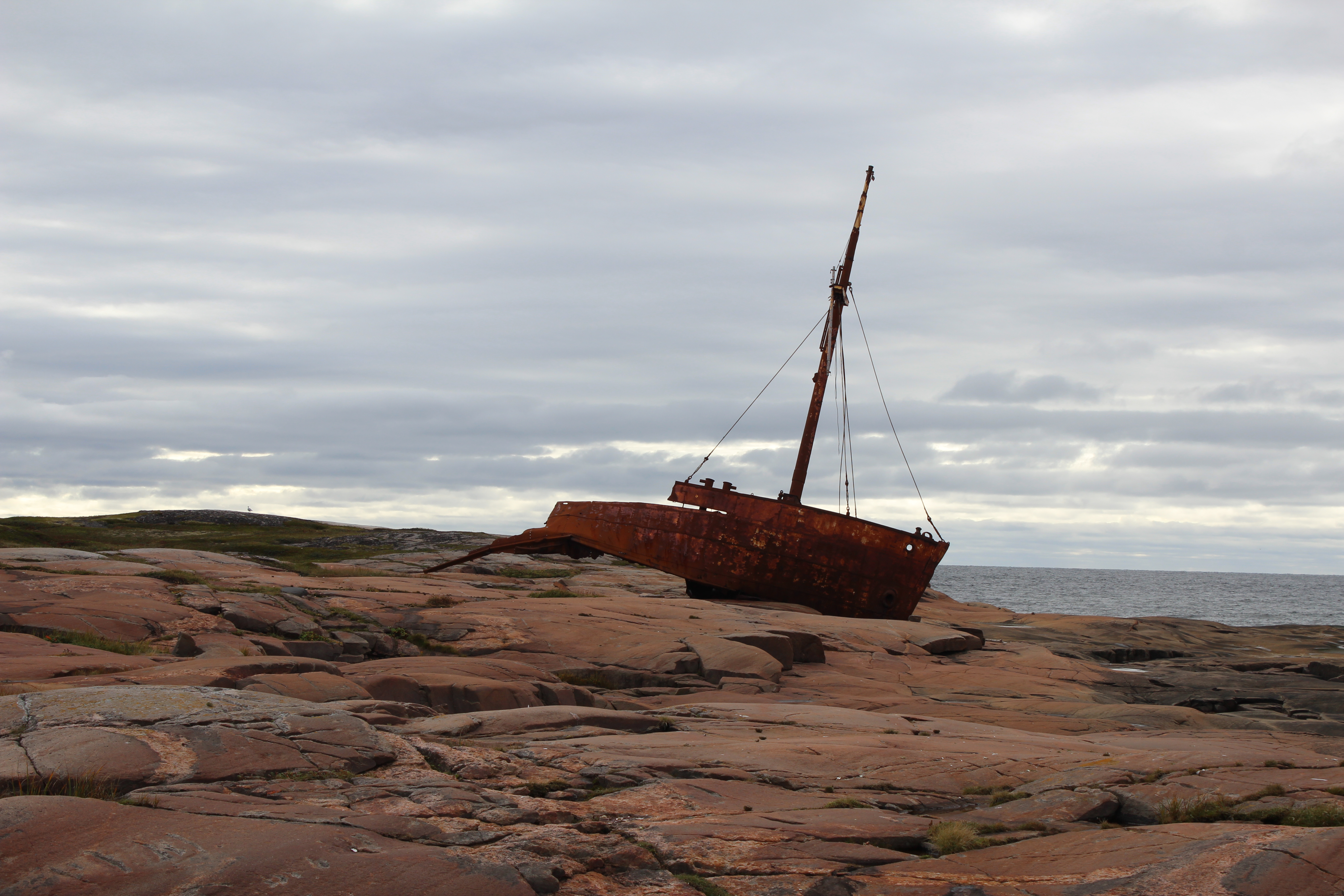
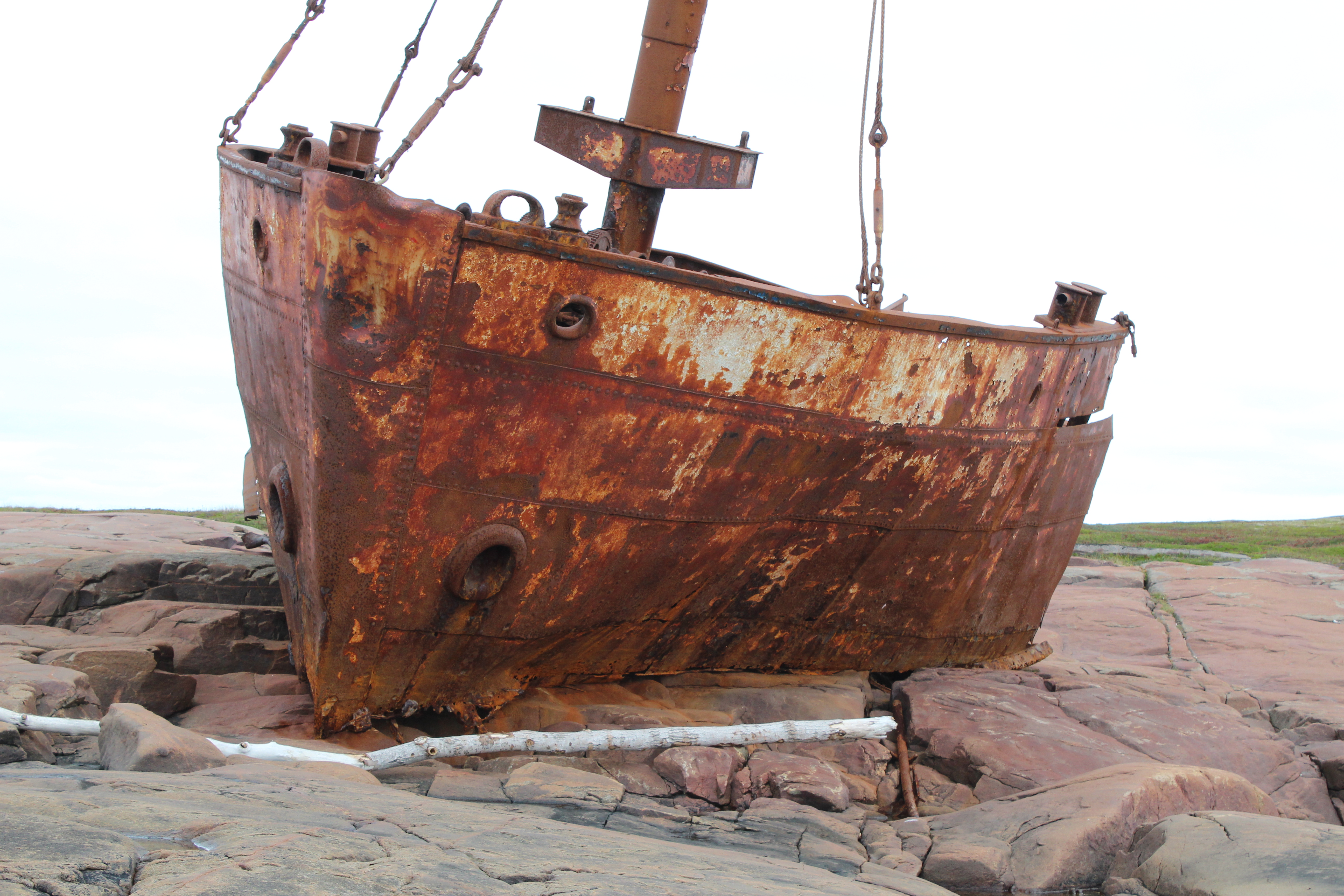
Sadly there’s the front end of the wreck of a ship dating back to the 70s on this presqu’ile, one M. V. Brion which piled up with no loss of life, but no doubt lots of heartache for all involved.
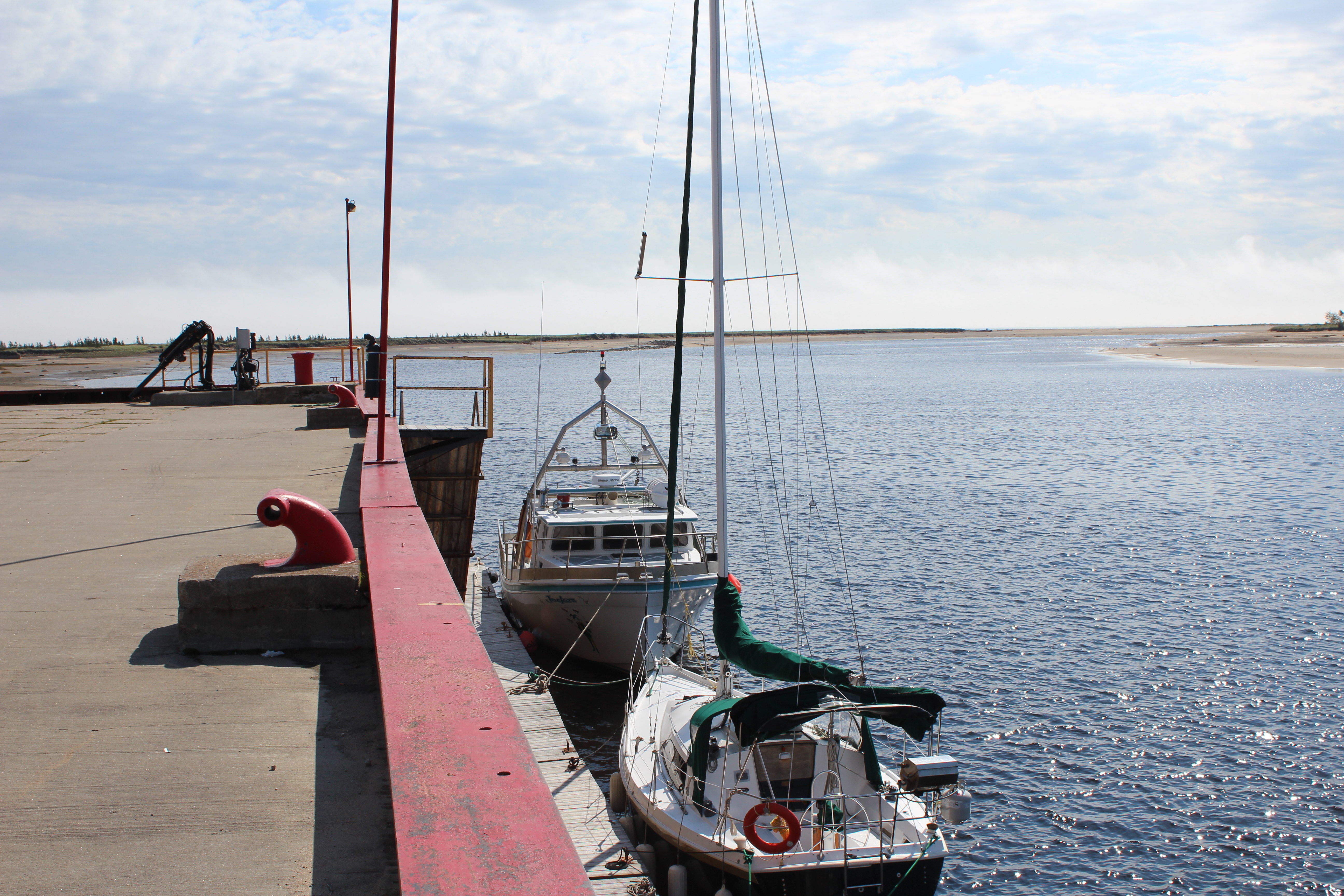
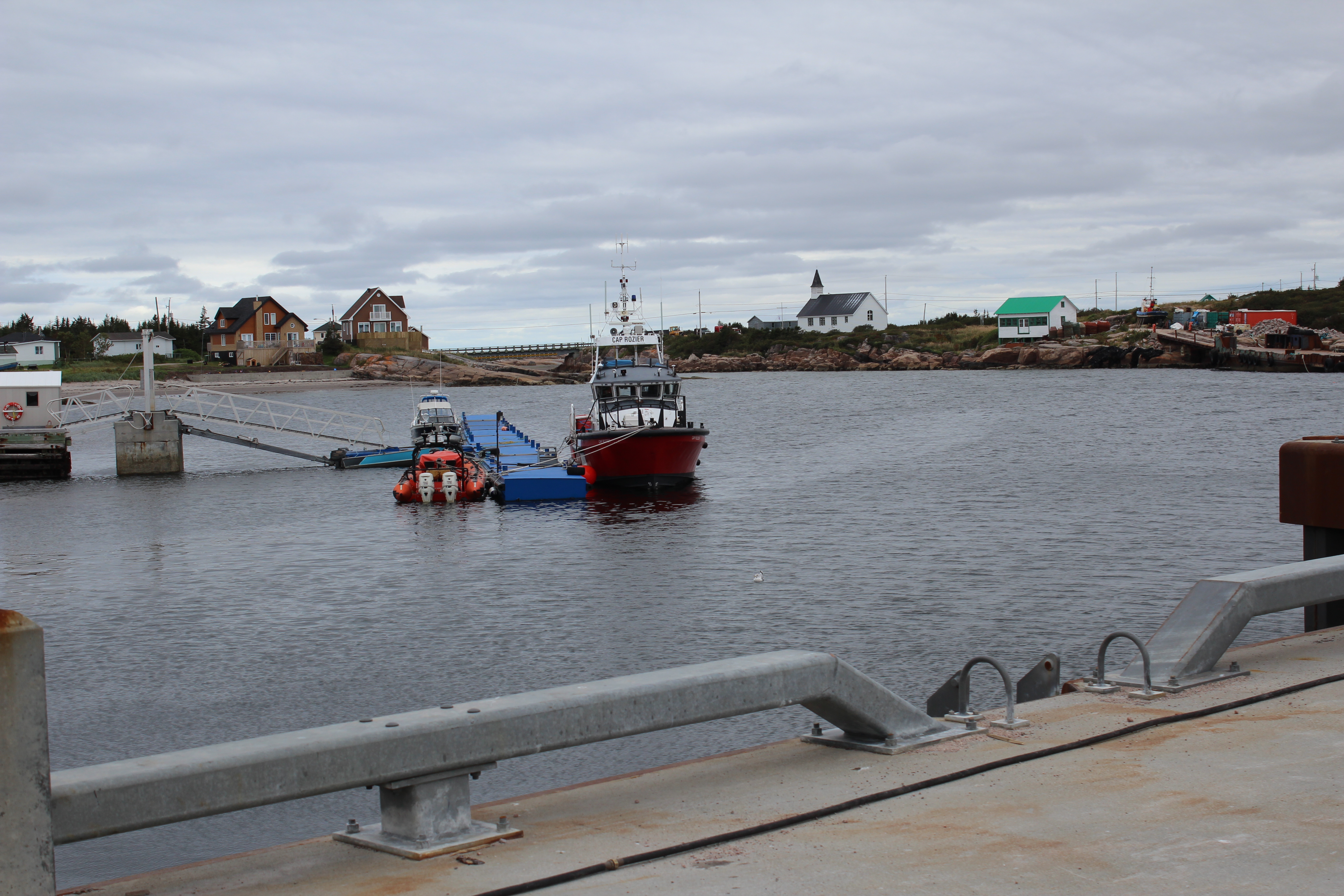
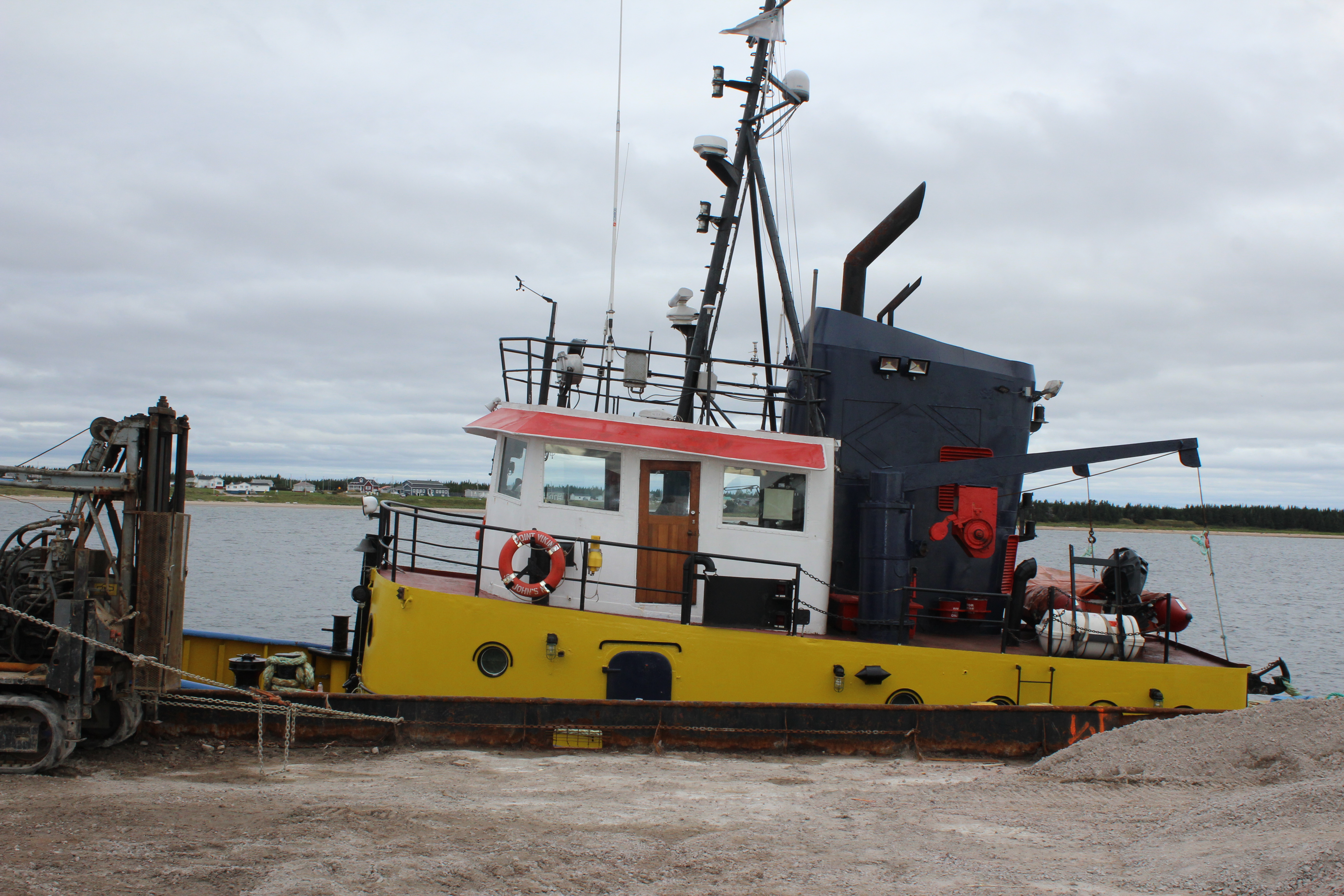
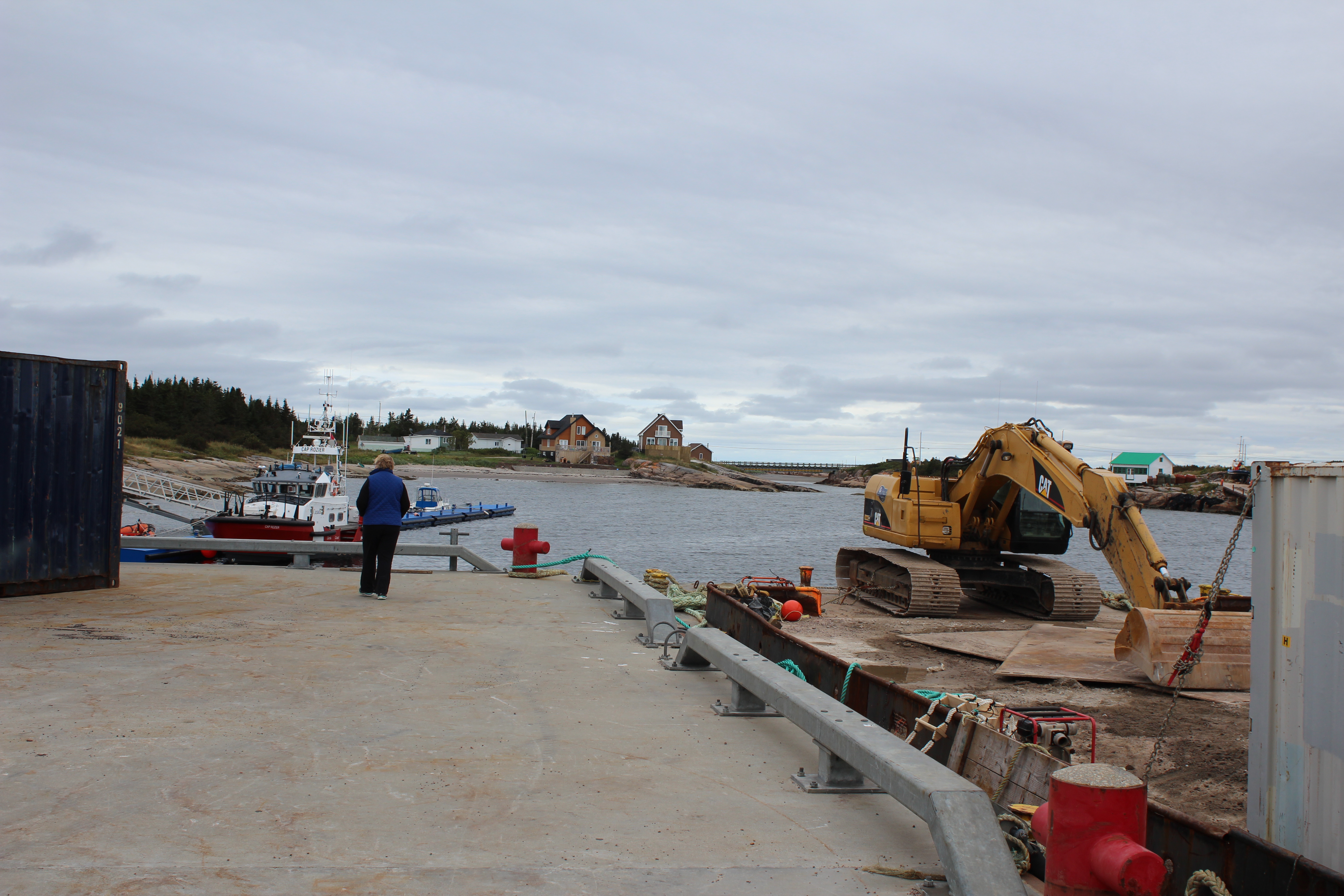
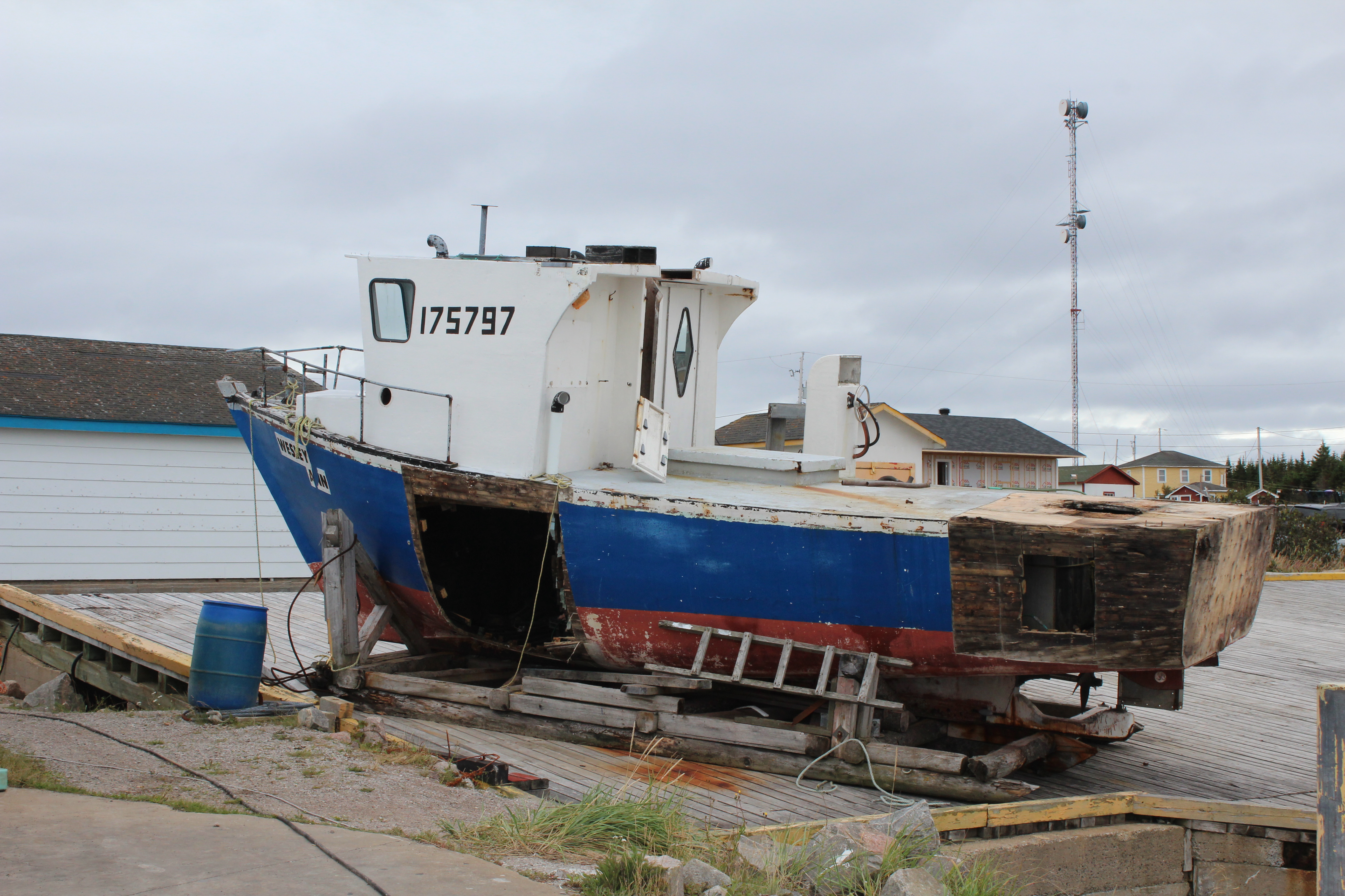
The wharf was completely empty of people but there were cars parked everywhere which we assumed meant a very active fishing fleet that was out of sight at sea. There were a few floating docks, a Coast Guard ship like the one in Tad, some small boats tied up, and quite a few buildings to deal with the incoming catch. There was even a wooden fishing boat with gaping holes in the side, we assumed in the process of a rebuilding project.
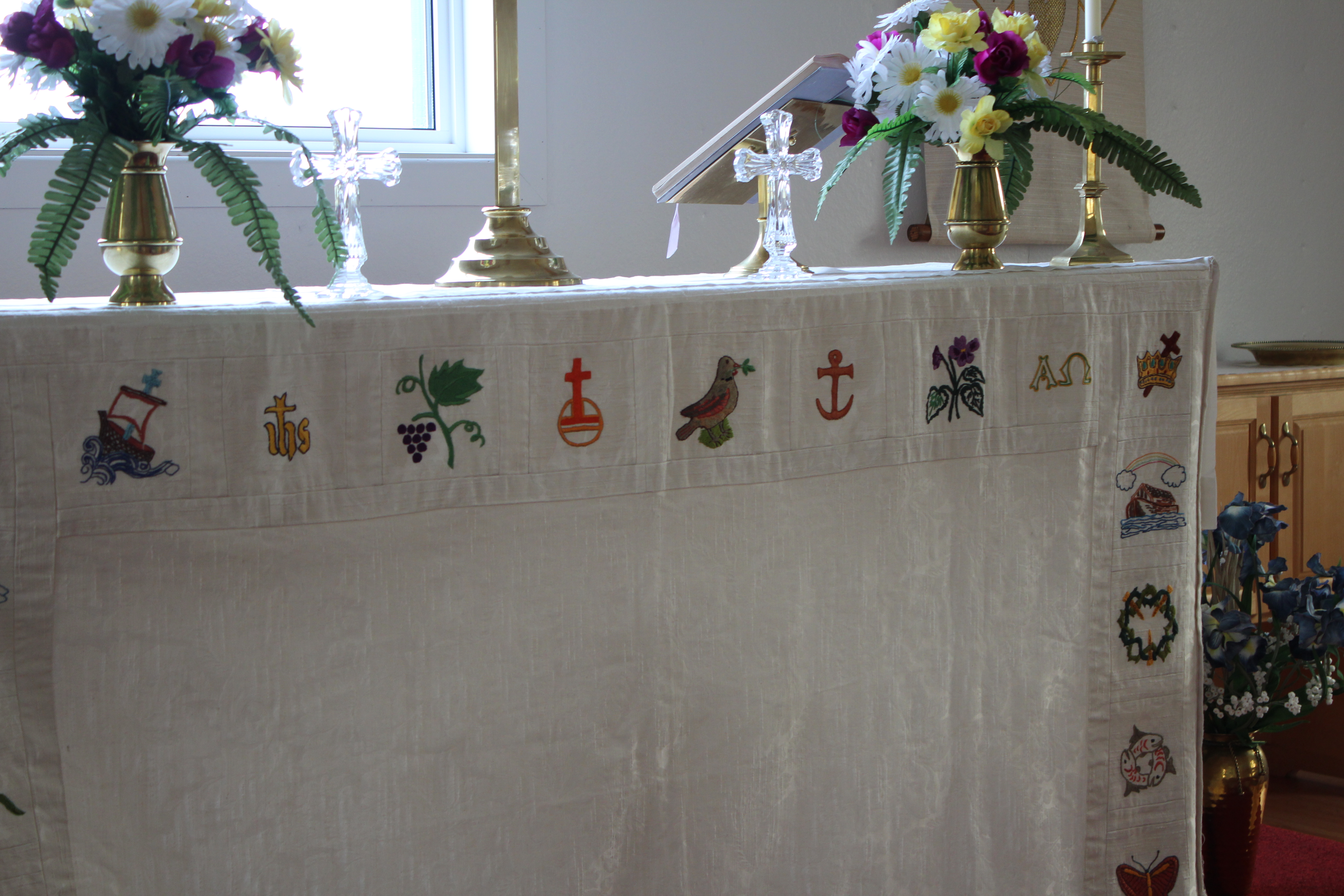
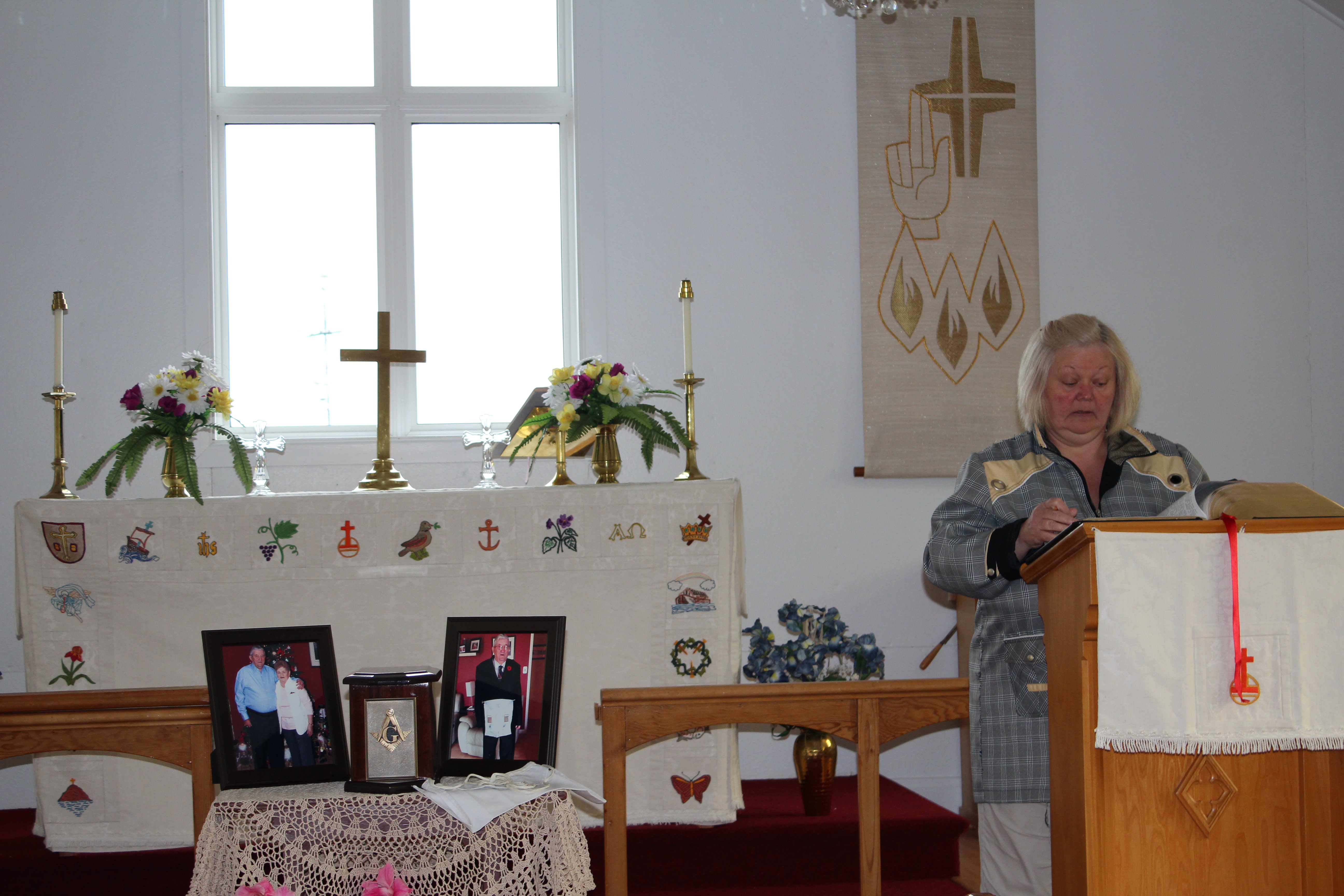
There is a little Anglican Church which we were lucky enough to get into. The priest and her husband had just arrived to prepare for a funeral so we snuck in empathizing quietly with the tourists who venture into our chapel when we go in to do the flowers. They were very welcoming. Kegaska is mostly an English community (of 300 people) and the priest told us that she had lived up the coast in Harrington Harbour but now was located here. The other communities further down the coast are mostly English-speaking.

I commented to someone before we left on this trip that we were going to see the coast to make sure we’d retired in the most beautiful part. Reflecting on what we have seen all the way down the coast I developed a theory. God created the north shore starting from the Gulf end. Kegaska was an early work, and on creation came up the coast, an inlet here, a salmon river there, some small islands in this part, endless sandy beaches in that part. Rock and sand and marsh and forest in endless variety of shape and form until she got to Tadoussac. Kegaska was still in the back of God’s mind so she asked, “How can I make that bay even better?”
Another kilometer long crescent beach, another rocky outcrop on a presqu’ile; why not put a rocky outcrop at both ends? Why not make the presqu’ile a little tighter – same use for a wharf but at the other end more space and another rock cut where someone could put gates one day and have a dry-dock. And we’ll have a much bigger river here than a mere salmon river, something ships can go up for miles, a fjord say, (well, a baby fjord) and instead of rocky islands off we’ll put a few reefs to protect it from the worst of the waves. Kegaska 2, new and improved, but the same basic concept. Judy Garland famously said “there’s no place like home.” It turns out there IS a place like home, but home is bett er!
er!
What a trip indeed! Thanks for taking us on it.
I so enjoyed your Tad series, but was sorry I didn’t get to see more of you and your winterised house when I was there.
You are very welcome. we may be out your way in December before Christmas. if near you will come for tea!
It would be great to see you on Salt Spring near Christmas! Are you on your way to California or what?
That was one fine road trip! – with an entertaining and edifying narrative. Thanks for sharing.
Thanks rob. It was indeed a great trip and nice to share it.
Love following your adventures!! Thanks so much !!
thanks Catherine. It was a great trip
What great story tellers you both are! I had no idea these towns even existed eventhough I was born in this province. Loved the quirky places, huge churches in tiny towns as per usual in Quebec but these were really tiny towns, coast and beaches so beautiful!
So please continue your adventures, it’s a hoot to travel vicariously with you guys!
Colleen & Dennis